
Geomorphology
1 reportGeomorphology is an Earth-science method used to measure subsurface structure, surface change, fluids, hazards, or environmental history. The method is judged through measurement principle, geophysical inversion, and calibration standard, especially where design choices change uncertainty or causal interpretation.
For readers assessing Geomorphology, the relevant threads are measurement principle, while also considering survey design and spatial resolution. The strength of statements about measurement principle depends on how well comparison with independent methods is supported by field validation; the result is bounded by the possibility that coverage, noise, and inversion assumptions can limit subsurface or surface interpretation.
For readers assessing Geomorphology, the relevant threads are measurement principle, while also considering survey design and spatial resolution. The strength of statements about measurement principle depends on how well comparison with independent methods is supported by field validation; the result is bounded by the possibility that coverage, noise, and inversion assumptions can limit subsurface or surface interpretation.
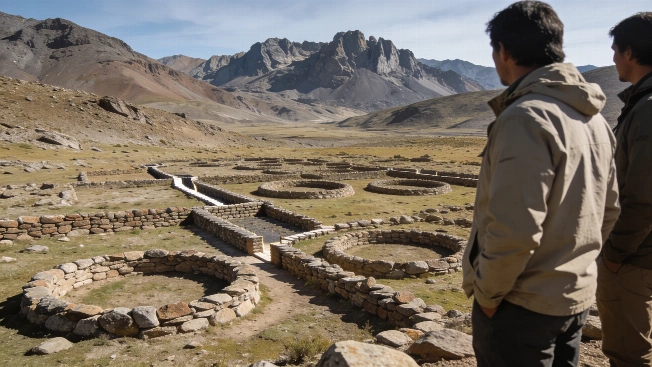
Argentina's Andes Reveal Vast Stone Circles With Unknown Purpose
A remote survey in Mendoza province has confirmed huge circular stone structures linked by passageways at more than 3,000 meters above sea level. Their date and purpose remain unresolved