Archaeologists have identified 45 stone-lined graves and ship timber fragments on Svalbard using non-invasive survey methods, raising new questions about burial traditions and the preservation of Arctic heritage under threat from erosion
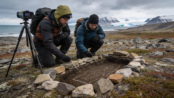
Arctic archaeological sites are disappearing as thawing permafrost and coastal erosion speed up, and recent fieldwork on Svalbard shows how much is at risk. During the 2026 Spitsbergen Archaeological Expedition, researchers from the Institute of Archaeology of the Russian Academy of Sciences recorded a previously undocumented necropolis with 45 stone-lined graves on Prins Karls Forland. They also found ship timber fragments and signs of historic Pomor activity. The team used non-invasive survey and digital documentation, since Norwegian law bans excavation and artifact removal at these protected sites. According to the Norwegian Directorate for Cultural Heritage, these restrictions are part of a broader effort to protect Svalbard's archaeological record, focusing on in situ preservation and non-invasive research.
Burial evidence and cultural attribution
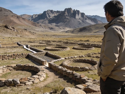
The cemetery near Cape Fuglehuken is notable for its stone-covered graves, a construction style not typical of known Pomor burials. A wooden cross was found in the southern part of the cemetery-an element linked to Pomor traditions-but the overall grave design complicates clear cultural identification. Researchers have not determined who was buried here, and the mix of features could point to an undocumented Pomor variant or a different group entirely. Because excavation is not allowed, skeletal remains and artifacts remain untouched, which limits direct study but keeps the context intact for future work. As of the latest review of major wire services and Norwegian heritage portals, there is no independent confirmation of the reported 45 stone-lined graves, and no official statements from Norwegian or Russian authorities about this necropolis have been released.
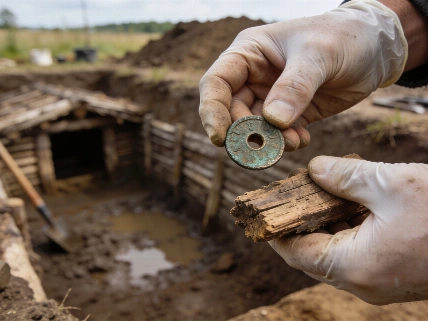
Elsewhere on Prins Karls Forland and the west coast of Spitsbergen, the expedition found fragments from four ship keels and frames, plus an unusual piece of ship planking joined with wicker. One timber fragment was discovered inland, beyond the coastal ridge, in an area with some of the earliest driftwood deposits on the Sarsa Peninsula. These finds add to the record of historic maritime activity in the region, but their exact age and cultural links are still unclear. This difficulty in attribution is common in Arctic research, where Russian Pomor, Norwegian, and earlier hunting and trading groups have left overlapping traces, as discussed in comparative studies in journals like Nature and Science.
Threats to preservation
The Pomor settlement and necropolis at Ebeltofthamna, on the north shore of Krossfjorden, show how vulnerable Arctic archaeological sites are. The settlement includes three residential complexes and related burial grounds, with artifacts such as a leaf-shaped pectoral cross, Dutch white-clay pipes, ceramics from the 17th and 18th centuries, leather shoes, and iron objects exposed along the coastal cliff. Since removing artifacts is not allowed, archaeologists created detailed 3D models of the finds in place. Analysis suggests the site was used off and on from the late 17th century through the first half of the 19th century.
The site is deteriorating quickly. Surveys in 2025 showed significant erosion, and by 2026, the damage had worsened. Researchers estimate that if current trends continue, the site could be lost within decades. Erosion is already affecting the nearby Pomor necropolis, where only the remains of crosses and two rows of graves survive on a marine terrace. In one grave, a partially exposed skull allowed for digital recording and facial reconstruction, but ongoing loss of context threatens the value of the evidence. The vulnerability of Arctic heritage to climate-driven change has been documented by international research teams, including those from the Max Planck Society and the University of Oslo, who have reported similar losses across the circumpolar north.
Survey methods and site monitoring
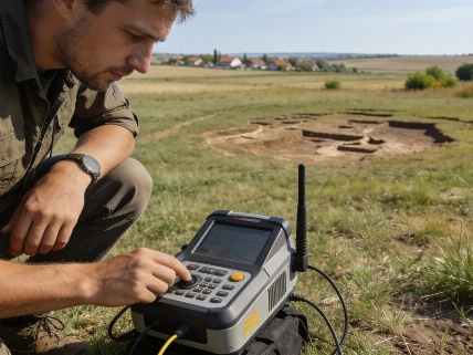
With excavation off-limits, the expedition focused on non-invasive survey, monitoring, and digital documentation. The team covered large areas of western Spitsbergen and the northern tip of Prins Karls Forland, using remote sensing and photogrammetry to record features without disturbing the ground. Limited access to boats meant researchers had to walk 60 kilometers in a single day to reach and document the Stabbelva and Gravsjøn settlements. At Cape Kokerineset, the team examined an area where Norwegian researchers had previously found ship timbers, tentatively linked to a Russian vessel. Archaeologists are now seeking access to the recovered material for further study. The use of advanced digital techniques for site monitoring is now standard in Arctic archaeology, as shown in recent Nature research articles on non-invasive heritage documentation.
The discoveries on Svalbard add to the archaeological record of historic maritime communities in the Arctic, but they also show how fragile this evidence is. As environmental change speeds up, the time available to document and interpret these sites is shrinking. This situation is similar to challenges in other regions where rapid environmental processes threaten archaeological context, as seen in recent reporting on the impact of natural events on site preservation.
Limits of interpretation
Without excavation or artifact removal, interpretation of the Svalbard graves and settlements relies on surface observation, digital modeling, and comparison with other sites. The stone-lined graves at Cape Fuglehuken remain undated and culturally ambiguous, and the ship timber fragments cannot be securely linked to specific voyages or communities. The Pomor settlement at Ebeltofthamna is better dated through associated ceramics and artifacts, but erosion has damaged the stratigraphic context, making further analysis difficult. 3D modeling preserves some information, but cannot replace the full range of archaeological investigation possible under different legal and environmental conditions. These constraints are a recurring theme in Arctic heritage research, as discussed in syntheses by the Norwegian Directorate for Cultural Heritage and international partners.
As Arctic sites become harder to reach or are destroyed, the need to document and protect what remains becomes more urgent. The Svalbard survey shows both the potential and the limits of non-invasive methods. Digital documentation can capture surface features and artifact shapes, but cannot recover buried evidence or reconstruct lost context. The future of Arctic archaeology will depend on balancing preservation, research access, and respect for legal and cultural rules. This balance is a subject of ongoing debate in leading journals such as Science and among research institutions including NASA, which has contributed remote sensing expertise to polar heritage monitoring projects.
Estimating the minimum number of individuals in a burial population is a basic concept in mortuary archaeology. This estimate is based on the most frequently represented skeletal element-such as the number of left femurs or skulls-rather than the total number of bones. For the Svalbard necropolis, the count of 45 stone-lined graves gives a minimum number of individuals, but without excavation, it is not possible to confirm whether each grave contains a single burial, multiple people, or is empty. This limitation affects demographic, health, and cultural interpretations, and highlights the importance of context and preservation in archaeological research.