Geophysical surveys in Lower Austria have mapped a Roman town with a regular street grid, burial grounds and an amphitheatre for about 8000 people. Researchers cautiously link it to Claudivium, but the identification remains unconfirmed.
A Roman town that may correspond to the long-missing Claudivium has emerged from geophysical surveys near the Danube in Lower Austria. The mapped settlement covers 25 to 30 hectares and includes a regular street network, extensive cemeteries and an amphitheatre large enough for about 8000 spectators. Independent Austrian and international reports describe the discovery as a geophysical identification rather than the result of a full excavation.
The scale is the critical evidence. This was not simply a cluster of civilian buildings beside a small military post: the planned layout and public arena point to an urban center with a regional role. Yet the identification remains provisional because most of the settlement has been detected remotely rather than exposed through broad excavation. In archaeological remote sensing, a coherent pattern of subsurface anomalies can establish the organization and extent of a site while leaving its precise name and individual building functions unresolved.
A useful comparison is provided by the way NASA treats remote-sensing data: imagery can reveal structures and spatial relationships, but interpretation still depends on ground verification. The same distinction is emphasized in methodological work published in Nature, where detection and identification are treated as separate evidentiary steps.
Planned urban center
The site lies near the hamlet of Stein in the municipality of St. Pantaleon-Erla, close to the River Danube. An interdisciplinary team involving the University of Innsbruck, the Danube Limes Forum, GeoSphere Austria, Research Archaeology and archaeological services in Upper and Lower Austria has investigated the roughly 10-kilometer stretch between Enns and St. Pantaleon-Erla since 2015. The role of regional earth-science expertise is reflected in the participation of GeoSphere Austria, whose work includes geophysical and geoscientific investigation of the Austrian landscape.
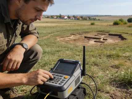
Geophysical measurements have traced streets, buildings, burial grounds and the amphitheatre. The arena is comparable in size to the one at Carnuntum, a major Roman center on the Danube. Cemeteries beside roads leading out of the settlement include graves, tombs and burial mounds, with some large monuments indicating that at least some residents possessed considerable resources.
The figures define the discovery: a 25 to 30 hectare town, a street grid, an amphitheatre for around 8000 people, and settlement activity dating from about AD 80 to approximately AD 180. The venue's capacity is especially important because it implies an audience larger than the roughly 500 soldiers associated with the nearby auxiliary fort. These estimates come from the mapped dimensions of the settlement and arena, not from a complete excavation or a direct count of preserved seating.
That mismatch between military garrison and urban infrastructure is why researchers regard Stein as an unusually ambitious foundation. The town appears to have been deliberately planned in a form resembling autonomous settlements elsewhere in Noricum, rather than growing gradually around a fort. At present, however, the surveys show urban planning without establishing the settlement's formal legal status or administrative rank.
Frontier infrastructure
The urban evidence sits within a military landscape built around movement across the Danube. A Roman stone fort identified in 2017 dates to the second century AD, while later geophysical work detected an earlier timber-and-earth fortification from the first century.
The position east of the River Enns helped control a Danube crossing near the mouth of the Aist. The Aist Valley also offered a short route between the Danube and the Vltava, or Moldau, connecting Roman territory with regions beyond the empire. Temporary camps north of the Danube suggest that Roman forces operated across the river as well, possibly during efforts to pressure or control Marcomannic territory.
At Albing, within the same modern municipality, archaeologists found evidence for a planned legionary fortress that was never completed. Foundation trenches and substantial bases for fortifications and a headquarters had been prepared before construction stopped. Together with Stein, the site records a frontier being repeatedly reorganized rather than a fixed military line.
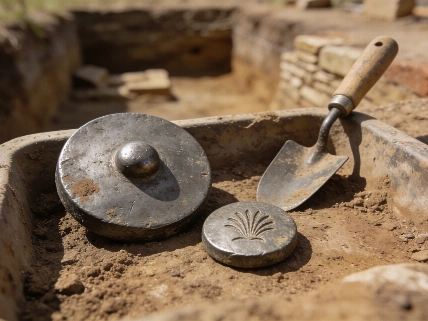
The abandonment of Stein appears to have been orderly. Researchers have found no evidence that the town was destroyed in a battle or catastrophe, and the available evidence instead points to a planned withdrawal around AD 180. This interpretation remains dependent on the current geophysical picture and associated dating evidence, so targeted excavation could still refine the sequence.
The Claudivium question
The proposed identification rests partly on geography. The second-century geographer Claudius Ptolemy recorded Claudivium at coordinates that researchers say fit the Stein settlement, while his description of a river entering the Danube from the north may correspond to the Aist.
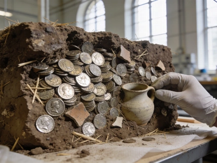
Chronology offers a second connection. Coin evidence places the abandonment near the death of Marcus Aurelius and the accession of Commodus, when Rome was changing its strategy after the Marcomannic Wars. The conflicts had occupied the Danube frontier since AD 166, and peace agreements under Commodus were followed by a consolidation of Roman power at Lauriacum, modern Enns.
Some inhabitants may have moved to Lauriacum. Bronze-casting equipment and comparable fibula types, or Roman garment fasteners, occur at both locations. Within roughly 50 years, Lauriacum had expanded to about three times the size of the abandoned Stein settlement, while Stein appears to have been dismantled for reusable building materials.
That sequence supports a strategic relocation, but it does not by itself prove that Stein was Claudivium. Ptolemy's coordinates are an important clue rather than a site label, and the river comparison is interpretive. Targeted excavation and additional analysis will be needed to connect the mapped town securely with the written name.
The discovery adds a useful counterpoint to another Roman settlement study in which destruction by fire helped define a site's history. At Stein, the absence of destruction is itself significant: abandonment and later material removal seem to have shaped the archaeological record.
What the surveys cannot show
Geophysical surveying can map buried structures and spatial patterns without exposing every building, but it cannot automatically establish how each structure was used or who occupied it. A detected line may represent a wall, street edge or another subsurface feature, and the interpretation becomes stronger when excavation confirms the signal.
The site therefore offers a narrow historical window but not a complete social biography. The mapped cemeteries suggest differences in wealth and burial investment, while the amphitheatre demonstrates the capacity for large public gatherings. Neither category alone identifies the town's political status, its full population or the identities of its residents.
Further work combining aerial archaeology, geophysics, targeted excavation and natural-science analysis could test the proposed chronology and clarify the relationship between Stein, the forts and Lauriacum. Researchers have said that sustained medium- and long-term funding has not yet been secured, limiting how quickly those questions can be addressed. Collaboration with the University of Innsbruck and regional archaeological services should also help connect subsurface maps with material evidence recovered from carefully selected excavation areas.
Geophysical evidence is strongest when it is treated as a map of archaeological possibilities rather than a substitute for excavation: it reveals organization, scale and buried contrasts, but not every building's function. That distinction matters here because the street grid and amphitheatre make Stein an unmistakably substantial Roman settlement, while the Claudivium attribution remains a well-supported hypothesis rather than a confirmed identification. The evidence already establishes a major and deliberately planned frontier town that was abandoned during a strategic realignment, making this discovery valuable precisely because it narrows the historical problem without pretending to solve it.