Archaeologists have identified more than 25 underwater sites along Saudi Arabia's Red Sea coast using sonar and photogrammetry, uncovering shipwrecks and submerged structures that document ancient trade and migration routes.
Archaeologists working along Saudi Arabia's Red Sea coast have recorded more than 25 underwater sites, including shipwrecks and submerged structures. These finds reveal a long history of maritime activity across different eras. The discoveries come from systematic surveys using marine sonar, bathymetric mapping, and photogrammetry. Together, these methods are giving researchers a clearer view of how the Red Sea served as a route for trade, migration, and cultural exchange. The Saudi Heritage Commission, following international standards from organizations like UNESCO and research protocols used by the Max Planck Society, defines underwater cultural heritage as traces of human activity submerged for at least 100 years. This includes shipwrecks, cargo, and related archaeological material.
Surveying the seabed
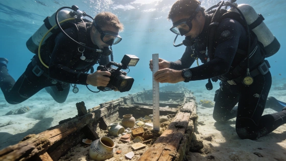
The most recent large-scale survey, launched by the Heritage Commission in 2022, covered about 400 square kilometers between Umluj and Ras Al-Sheikh Hameed. Working with both Saudi and international partners, archaeologists used GPS to map anomalies on the seabed. Underwater photography and high-definition video provided detailed records of what they found. Photogrammetry allowed the team to create three-dimensional models of shipwrecks, helping them study preservation and layout without disturbing the sites. This approach follows current best practices in digital archaeology, where non-invasive documentation is preferred to protect fragile remains for future research.
Earlier surveys had already found shipwrecks from the Roman and early Islamic periods, including sites between Rabigh and Shoaiba documented in a 2012 project with Philipps University of Marburg. Later work at the Umluj wreck site in 2015 and 2016, in partnership with the University of Naples L'Orientale, showed that submerged sites can preserve cargo, hull construction, and other evidence of seafaring long after ships were lost. These collaborations reflect a wider trend in international maritime archaeology, as seen in recent Nature research articles on underwater site preservation.
Material evidence and dating
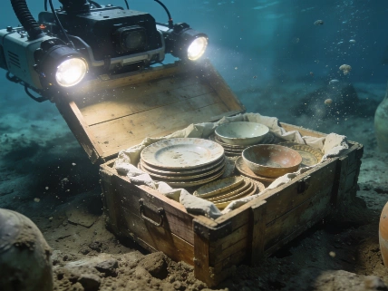
Underwater cultural heritage includes material evidence of human activity that has been underwater for at least a century. The shipwrecks and cargoes found along the Saudi coast include ceramics, metal fittings, and wooden timbers. Some can be dated by their style or by where they were found. When organic material is preserved, radiocarbon dating is possible, but many finds are dated by comparing artifacts and looking at their context. The range of periods-from Roman-era ships to early Islamic wrecks-shows the Red Sea's long role as a link between Arabia, Africa, Asia, and the Mediterranean. Peer-reviewed studies in journals such as Science have stressed the value of using several dating methods to build reliable timelines for underwater sites.
Keeping the archaeological context of these finds is essential. The position and grouping of artifacts in a wreck can reveal details about ship construction, cargo, and how the vessel was lost. Archaeological divers only excavate when further investigation is needed, and any sampling for scientific analysis follows strict protocols to limit disturbance.
Preservation and documentation
Saudi Arabia ratified the 2001 UNESCO Convention on the Protection of the Underwater Cultural Heritage in 2015, committing to document and preserve submerged archaeological remains. The Heritage Commission's ongoing program aims to train local specialists in underwater archaeology and produce digital models for long-term monitoring. These efforts are part of a broader regional shift, as digital recording and non-invasive survey methods become standard for managing underwater sites. The use of advanced documentation techniques matches recommendations from international bodies such as NASA, which has developed remote sensing and digital modeling for hard-to-reach environments.
The scale of recent discoveries stands out. More than 25 underwater archaeological sites were identified in a single survey, showing how much material is preserved along the Red Sea coast. This highlights the region's archaeological potential and the need for careful management to prevent loss from natural or human causes.
Interpreting maritime connections
The Red Sea's archaeological record challenges the idea of the sea as a barrier. Instead, the evidence points to centuries of contact, with shipwrecks and submerged structures providing direct links between distant regions. Documenting these sites gives a more detailed picture of Saudi Arabia's role in ancient maritime networks, adding to what is known from land-based archaeology about trade, migration, and pilgrimage.
Similar advances in digital documentation have been reported elsewhere, such as the investigation of a Turkic stone statue in Kyrgyzstan, where photogrammetry expanded the record without physical excavation. Using these methods in the Red Sea reflects a move toward minimally invasive archaeology, focusing on preservation and long-term research value rather than quick excavation.
The underwater sites found so far are only a small part of the Red Sea's submerged heritage, but their documentation is an important step in reconstructing the region's maritime past. The evidence supports the view of the Red Sea as an active, connected space. As digital models and systematic surveys continue, the challenge will be to combine these underwater records with broader archaeological research, making sure preservation keeps up with discovery and that interpretations stay grounded in the material evidence.
Photogrammetry is a digital recording method that uses overlapping photographs to create accurate three-dimensional models of objects or sites. In underwater archaeology, it lets researchers document shipwrecks and submerged structures in detail without disturbing them. The resulting models help assess preservation, plan research, and monitor changes over time. This approach is now widely used for managing fragile or hard-to-reach sites, as it preserves context and allows remote analysis by specialists.