Archaeologists using ground-penetrating radar have identified a substantial medieval stone wall outside the Selja monastery in western Norway, raising new questions about the scale and complexity of this early Christian site
A previously undocumented medieval stone structure has been identified outside the known boundaries of the Selja monastery complex in western Norway, according to recent fieldwork by the Norwegian Institute for Cultural Heritage Research (NIKU). The discovery, made through ground-penetrating radar and digital landscape analysis, suggests that the island of Selja may have supported a more extensive and varied medieval community than previously recognized.
Evidence for a Larger Settlement
The newly detected feature consists of a stone wall measuring approximately two meters in thickness and extending at least 13 meters south from the area near the island's pier. Only a portion of the structure has been investigated so far, but geophysical data indicate that the masonry continues underground. The wall's substantial width points to a robust construction, but its full extent and original function remain undetermined pending further excavation and analysis.
Importantly, the structure lies outside the established monastic enclosure, raising the possibility that it may be associated with earlier or parallel phases of religious or secular activity on Selja. Soil and datable material samples have been collected for laboratory analysis, which may help clarify the chronology and use of the building. Researchers are considering whether the structure relates to the Benedictine monastery, the 11th-century bishopric, or the earliest Christian settlement linked to the cult of St Sunniva.
Recent Discoveries and Context
Selja, located in Stad municipality, Vestland County, is a site of major historical significance in Norway's Christianization. The island is traditionally associated with St Sunniva, a figure believed to have sought refuge there in the 10th century. Later, Selja became the seat of western Norway's first bishopric and saw the establishment of a Benedictine monastery, with documented expansion during the 12th to 14th centuries CE.
Over nearly two centuries, the monastery and shrine complex have been the focus of archaeological and historical research. However, recent advances in digital archaeological methods have revealed that much of Selja's medieval landscape remains unexplored. In 2024, researchers identified traces of an earlier stone church beneath the ruins of St Sunniva Church, displaying architectural features consistent with Anglo-Saxon traditions. The following year, another previously unknown medieval ruin was located northwest of the monastery, further supporting the idea of a broader settlement. These findings, together with the current discovery, indicate that Selja's medieval occupation extended beyond the well-known religious buildings.
Digital Methods and Ongoing Uncertainty
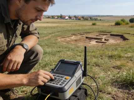
The use of ground-penetrating radar, terrain modeling, and remote sensing has been central to these discoveries. Surveys conducted in 2022 first revealed several buried structures, enabling archaeologists to target areas that had not been excavated despite decades of prior research. The application of these non-invasive techniques has allowed for the identification of substantial masonry features without disturbing the site, but full excavation and interpretation will depend on future funding and research priorities.
While the new structure's age and function are not yet established, the collection of soil and datable material is expected to provide chronological and functional information. Until laboratory results are available, interpretations remain provisional. The evidence so far suggests that Selja was not solely a monastic or pilgrimage destination but may have supported a more complex medieval community. Comparable approaches have been used at other European sites, such as the multi-century urban excavations in Kaliningrad's Far Forstadt district, which have revealed layers of settlement and infrastructure beyond initial expectations (see coverage of urban archaeology in Königsberg).
Numerical and Analytical Details
The stone wall identified at Selja measures approximately two meters wide and extends for at least 13 meters, based on current geophysical survey data. The structure's full length and configuration remain unknown, as only a segment has been mapped and no complete excavation has yet taken place. Soil and material samples have been collected for dating, but results are pending. Previous geophysical surveys on the island have identified multiple buried features, but the current discovery represents one of the most substantial masonry elements found outside the known monastic precinct.
Ground-penetrating radar (GPR) is a non-destructive geophysical technique that uses electromagnetic pulses to detect subsurface structures. In archaeological contexts, GPR can reveal buried walls, foundations, graves, and other features by measuring differences in the reflection of radar waves. The method is particularly valuable in sensitive heritage sites where excavation is limited or prohibited. However, GPR results require careful interpretation and are most effective when combined with targeted excavation and laboratory analysis of recovered materials. At Selja, GPR has enabled researchers to identify substantial stone features beneath the surface, guiding future research and conservation efforts while minimizing disturbance to the site.