Archaeologists have identified a seventh Roman military camp near the Iron Age hill fort of La Loma in northern Spain, revealing a more extensive siege network during the Cantabrian Wars than earlier evidence suggested
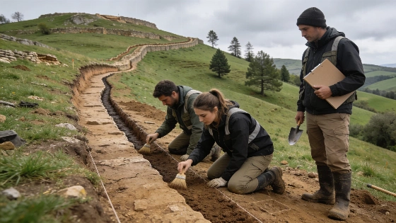
Archaeological excavations near the Iron Age hill fort of La Loma in northern Spain have revealed a previously undocumented Roman military camp, expanding the known scale of Roman operations during the Cantabrian Wars. The newly identified site, designated as Site F, was uncovered by teams from the Monte Bernorio Institute for the Study of Cantabrian Antiquity (IMBEAC) and Heroica Arqueología y Patrimonio Cultural. This discovery brings the total number of confirmed Roman military positions encircling La Loma to seven, indicating a more complex and coordinated siege than earlier research had established.
Expanding the Roman Siege
Prior to the most recent fieldwork, only three Roman camps had been securely identified in the area: a principal encampment and two smaller castella, or secondary positions. Over the last two excavation seasons, researchers have mapped three additional camps and the routes connecting them, culminating in the identification of Site F. The spatial arrangement of these camps suggests a deliberate strategy to isolate the fortified settlement at La Loma, consistent with Roman military doctrine for besieging resistant communities.
Material evidence from the new camp includes coins and other artifacts that support a date for the siege between 26 and 24 BCE, with 25 BCE considered the most probable year. This period aligns with Emperor Augustus's campaign to subdue the last independent groups in northern Hispania. The density and distribution of the camps imply that the Roman force involved may have numbered between 12,000 and 18,000 soldiers, making this one of the largest military operations of the conquest.
Archaeological Evidence and Interpretation
The identification of Site F relied on a combination of surface survey, excavation, and analysis of material finds. The camp's features, including defensive earthworks and associated artifacts, match those of other Roman military installations in the region. The presence of military routes linking the camps further supports the interpretation of a coordinated siege network. However, the full extent of the Roman encirclement remains uncertain. Some camps may have been destroyed by later settlement expansion or remain buried beneath modern infrastructure, complicating efforts to reconstruct the complete siege system.
Researchers caution that while seven camps have now been documented, the original network could have been even larger. The possibility of additional, as-yet-undiscovered camps is supported by gaps in the current distribution and by the challenges of detecting archaeological features in developed or disturbed areas. This pattern of incomplete preservation is a common issue in the study of ancient military landscapes, as highlighted by investigations at other Roman frontier sites, such as the discovery of ritual practices beneath barracks floors at Vindolanda near Hadrian's Wall (see related research).
Scale and Historical Context
The Cantabrian Wars, fought from 29 to 19 BCE, marked the final phase of Rome's conquest of the Iberian Peninsula. The resistance of the Cantabrian and Asturian peoples required sustained military campaigns, with the siege of La Loma representing a decisive episode. The newly mapped siege network at La Loma provides direct evidence for the logistical and organizational capacity of the Roman army in this period. The estimated troop numbers, based on the size and number of camps, suggest a scale of operation comparable to other major Roman campaigns in Europe.
Despite the advances in mapping and interpretation, significant uncertainties remain. The dating of the camps relies on numismatic and artifact evidence, which can provide only approximate chronological resolution. The absence of written records specifically describing the siege at La Loma means that archaeological data must be interpreted within broader historical frameworks. Ongoing excavation and survey work may clarify the full extent of the Roman presence and the strategies employed during the campaign.
Preservation and Research Limitations
The archaeological record at La Loma is shaped by both ancient and modern processes. Later construction, agricultural activity, and urban development have likely destroyed or obscured some Roman features. Preservation bias means that the current map of camps may underrepresent the original siege network. Researchers emphasize the importance of integrating remote sensing, targeted excavation, and comparative analysis to refine understanding of the site's military landscape.
The discovery at La Loma contributes to a growing body of evidence for the complexity of Roman military operations in newly conquered territories. It also underscores the challenges of reconstructing ancient conflict from incomplete and sometimes ambiguous material remains. As new methods and technologies are applied, further discoveries may continue to reshape interpretations of the Cantabrian Wars and their impact on the communities of northern Spain.
Understanding the archaeological context of Roman military camps requires careful attention to both physical remains and the processes that affect their preservation. Defensive earthworks, artifact scatters, and route traces can be identified through a combination of field survey, excavation, and geophysical methods. However, the survival of these features depends on factors such as soil conditions, later land use, and modern development. Archaeologists must account for these preservation biases when estimating the original extent of ancient military networks, recognizing that the absence of evidence does not necessarily indicate the absence of past activity.