Archaeologists have identified the buried choir of a Franciscan monastery church beneath Oslo Hospital using ground-penetrating radar, revealing foundations, possible graves, and a lost cemetery without excavation
Centuries of urban construction failed to erase the medieval footprint beneath Oslo Hospital, but it took ground-penetrating radar-not a trowel-to reveal the choir of a Franciscan monastery church hidden just below the modern city. The Norwegian Institute for Cultural Heritage Research (NIKU) mapped the nearly complete outline of the choir, along with possible altar foundations and traces of a brick-floored room, by scanning gardens and streets in 2018 and 2023. The radar also detected several grave-like anomalies, supporting the interpretation that a cemetery once occupied the area north of the church.
Remote Sensing in Urban Archaeology
Oslo Hospital stands on a site with over 700 years of documented history. The Franciscan friary was established around 1290 CE, and after the Reformation, the complex was converted into a hospital in 1538. Despite decades of archaeological investigation, the full plan of the monastery church remained elusive, largely due to the dense overlay of modern infrastructure-trenches, pipes, and cables that fragment and obscure older remains. The recent geophysical survey, however, produced a clear subsurface image of the choir, a feature that had previously evaded both excavation and archival research.
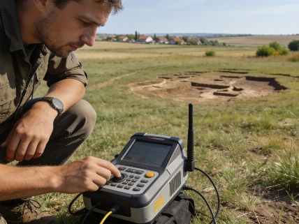
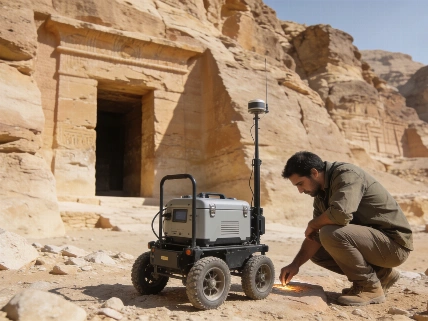
Ground-penetrating radar (GPR) works by transmitting electromagnetic pulses into the ground and recording the reflections from buried structures. In Oslo, this method allowed researchers to identify not only the choir but also features consistent with an altar base and a brick-floored chamber. The radar signatures of several possible graves add weight to the hypothesis that the friary's cemetery extended into what is now a built-up urban landscape.
Evidence, Limitations, and Comparative Finds
The Oslo survey is part of a broader shift in Norwegian archaeology toward non-invasive methods. GPR has previously identified buried Viking ships, such as the Gjellestad and Edøy vessels, and has revealed prehistoric longhouses missed by traditional trenching. At Sola in Rogaland, for example, a radar survey uncovered a three-aisled Iron Age longhouse that had survived undetected between earlier excavation trenches-a reminder that conventional sampling can leave significant structures in so-called blind zones.
In the Oslo case, the radar data covered a larger area than any previous excavation, providing a more comprehensive view of the buried monastery. The survey's results are detailed in the volume Archaeological Geophysics in Norway, published in August 2026, which documents the evolution of geophysical methods in Norwegian archaeology from the 1960s to the present. The project involved NIKU, the Archaeological Museum at the University of Stavanger, and several county heritage authorities. The findings echo those from other monastic sites, such as the Nonneseter Monastery in Bergen, where reported earlier excavations have focused on medieval burials and architectural remains.
While GPR can map subsurface features and guide future excavation, it does not replace the need for physical investigation. Radar data can indicate the presence and approximate form of buried structures, but direct excavation remains necessary to recover artifacts, analyze stratigraphy, and obtain samples for scientific dating. The Oslo survey demonstrates that geophysical and traditional methods are most effective when used together, allowing archaeologists to target their efforts and minimize unnecessary disturbance.
Interpreting the Buried Monastery
The radar-mapped choir and associated features at Oslo Hospital provide new evidence for the layout of the Franciscan monastery, but interpretation remains constrained by the limitations of remote sensing. Modern infrastructure complicates the identification of older features, and the radar cannot distinguish between different phases of construction or use without supporting excavation. The possible graves identified in the survey require further investigation to confirm their nature, date, and relationship to the church and cemetery.
Despite these challenges, the Oslo findings illustrate the value of integrating geophysical data with historical records and previous archaeological work. The ability to reconstruct the plan of a medieval religious complex beneath a functioning hospital, without disturbing the ground, marks a significant advance in urban archaeology. The evidence supports the survival of substantial medieval remains in Oslo's city center, even where centuries of building have altered the landscape above.
Norwegian archaeological geophysics has moved from experimental beginnings to a mature field capable of producing detailed maps of buried sites. The Oslo monastery survey stands as a case study in the strengths and limits of non-invasive methods: it reveals what survives, guides future research, and preserves the archaeological record for future generations. But it also underscores that radar images are not a substitute for excavation, analysis, and careful interpretation of context. The discipline's future will depend on balancing technological innovation with the slow, methodical work of archaeological science.
Ground-penetrating radar (GPR) is a geophysical technique that uses electromagnetic pulses to detect subsurface structures. In archaeology, GPR can identify walls, foundations, graves, and other features by measuring differences in how signals reflect from buried materials. The method is especially valuable in urban or sensitive sites where excavation is limited or impossible. However, GPR data require expert interpretation, and the results must be confirmed by excavation or other evidence before firm conclusions can be drawn about the age, function, or cultural context of detected features.