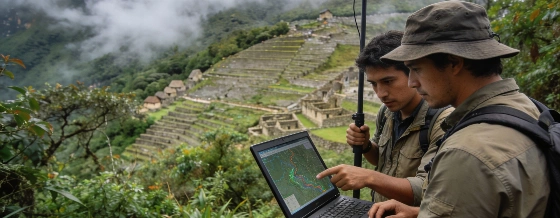
Archaeologists have mapped over 2.5 kilometers of previously unknown pre-Hispanic roads and possible agricultural features near Machu Picchu using airborne LiDAR, offering new insight into the Inca landscape hidden beneath dense cloud forest vegetation.
Recent archaeological survey work in the cloud forests surrounding Machu Picchu has identified more than 2.5 kilometers of previously undocumented pre-Hispanic roads and possible agricultural features, using airborne Light Detection and Ranging (LiDAR) technology. The findings, announced by Peru's Ministry of Culture, highlight the potential of remote sensing to reveal archaeological landscapes that are otherwise obscured by dense vegetation and challenging terrain.
Mapping the Hidden Landscape
The survey focused on the Mandor sector, east of the main Machu Picchu citadel, within the boundaries of the Machu Picchu National Archaeological Park. LiDAR, which uses laser pulses to measure ground elevation through forest cover, enabled researchers to detect subtle topographic features that are nearly invisible from the ground. Among the most prominent discoveries is a main road extending at least 1.2 kilometers, with a distinctive zigzag pattern consistent with known Inca construction techniques. Additional features interpreted as possible agricultural terraces and platforms were also identified, though their function and chronology remain to be established through further fieldwork.
Preliminary archaeological reconnaissance was carried out in July 2023, with the international research team combining expertise from the Center for Andean Studies at the University of Warsaw and Peru's Decentralized Directorate of Culture of Cusco. The project was led by Dr Jan Kłaput, with remote-sensing operations overseen by Dr Bartłomiej Ćmielewski. Fieldwork was supervised by Dr Nino del Solar Velarde, and the team included specialists from Wrocław University of Science and Technology, Apu Space, and Wrocław University of Environmental and Life Sciences.
Evidence and Uncertainty
The newly mapped road displays characteristics typical of Inca engineering, such as a zigzag alignment adapted to steep terrain. However, the precise age and function of the road and associated features have not yet been conclusively determined. Archaeologists emphasize that further targeted excavation and documentation will be required to establish construction methods, usage, and the relationship of these features to the broader Machu Picchu landscape. The Mandor sector's position suggests it may have played a role in controlling movement or organizing territory around the citadel, but this interpretation remains provisional.
In total, more than 2.5 kilometers of roads and related features were identified, representing a significant addition to the known infrastructure of the region. The survey area's rugged topography and dense vegetation have long limited conventional archaeological exploration, making LiDAR an especially valuable tool for mapping and hypothesis generation. The results contribute to a growing body of evidence that the Machu Picchu landscape was more extensively organized and interconnected than previously documented.
Conservation and Future Research
Following the discovery, heritage authorities in Cusco have initiated targeted archaeological studies to document, date, and assess the preservation of the newly identified features. These investigations will include field surveys, detailed recording, and evaluation of conservation needs. The research team and local officials have also highlighted the importance of integrating new technologies into archaeological practice, both for expanding knowledge and for guiding future conservation priorities.
The international collaboration behind this project reflects a broader trend in archaeological research, where advanced remote-sensing methods are increasingly used to investigate complex landscapes. Similar approaches have been applied in other regions, such as the use of ground-penetrating radar to identify medieval structures outside the Selja monastery in Norway, and in the study of early Murom burials at Zvyaginsky II, where archaeologists uncovered rare high-status graves and ceremonial artifacts.
Interpreting the Inca Landscape
Machu Picchu, constructed high in the Peruvian Andes and recognized as a UNESCO World Heritage Site since 1983, has been the focus of intensive archaeological research for over a century. Yet the surrounding landscape continues to yield evidence of a more extensive and complex system of roads, settlements, and agricultural areas than previously understood. The identification of additional routes and platforms in the Mandor sector raises new questions about how the Inca organized movement, land use, and territorial control in this mountainous environment.
Future research will aim to clarify whether the newly discovered roads were integrated into the wider Inca road system and how they connected Machu Picchu to other settlements and agricultural zones. The results may ultimately reshape our understanding of the region's pre-Hispanic occupation and the organization of its monumental and everyday spaces.
LiDAR is a remote-sensing technique that allows archaeologists to map ground surfaces by emitting laser pulses from an aircraft and measuring the time it takes for the light to reflect back. By filtering out vegetation, researchers can generate detailed digital elevation models that reveal subtle archaeological features such as roads, terraces, and building foundations. While LiDAR can identify potential sites and structures, ground verification and excavation remain essential for confirming the age, function, and cultural context of the features detected. The method has become increasingly important for archaeological research in forested or inaccessible regions, but its results must always be interpreted within the broader framework of field investigation and material evidence.