Astranis has announced the development of Perceptor satellites designed to monitor and analyze spacecraft movements in geostationary orbit, a region increasingly important for communications and national security
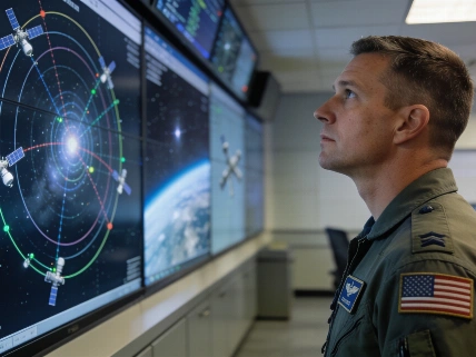
Efforts to monitor the crowded and strategically vital region of geostationary orbit (GEO) are set to expand with the introduction of a new class of satellites from Astranis. The San Francisco-based company has revealed plans for Perceptor, a line of spacecraft intended to provide detailed surveillance and situational awareness of satellite activity more than 35,700 kilometers above Earth's equator.
Geostationary Orbit as a Strategic Domain
Geostationary orbit, located at an altitude of 35,786 kilometers (22,236 miles), allows satellites to match Earth's rotation and remain fixed over a single longitude. This unique property makes GEO a preferred location for communications, weather monitoring, and reconnaissance satellites. As the number of operational spacecraft in this region grows, so does the complexity of tracking their movements and assessing potential risks from uncooperative or adversarial satellites.
Recent years have seen increased attention to satellite maneuvers in GEO, with several nations deploying spacecraft capable of close approaches and inspection. For example, in 2020, the U.S. Space Force reported that two Russian satellites approached within 160 kilometers of an American reconnaissance satellite, raising concerns about the potential for interference or surveillance. In 2023, Chinese GEO satellites were observed conducting proximity operations near U.S. military assets, highlighting the need for improved monitoring capabilities.
Perceptor Satellite Capabilities
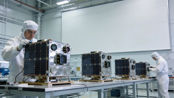
Astranis aims to address these challenges by leveraging its experience with MicroGEO satellites, which are smaller than conventional GEO platforms. The Perceptor line will incorporate a suite of sensors designed to characterize other satellites and their immediate environment. According to Astranis, these spacecraft will be able to perform multi-angle flybys, enabling the assessment of satellite capabilities, diagnosis of anomalies on friendly assets, and enhanced awareness of the broader GEO domain.
Each Perceptor satellite will use electric propulsion to maneuver throughout the GEO arc, allowing for repeated repositioning and flexible observation of multiple targets over its operational lifetime. The company states that this approach will help eliminate blind spots in GEO monitoring, a concern as more actors deploy advanced spacecraft to this orbital regime.
Mission Status and Operational Uncertainty
While Astranis has announced the Perceptor program, the company has not specified a launch date or detailed mission timeline for the first satellites. The current fleet of five Astranis satellites in GEO supports U.S. military communications, remote connectivity, and navigation services, but Perceptor represents a shift toward dedicated space situational awareness. The need for such capabilities is underscored by recent satellite maneuvers and the growing risk of unmonitored activity in high-value orbits.
As commercial and governmental interest in GEO surveillance increases, other nations are also advancing their own monitoring technologies. Japan, for instance, recently expanded its geostationary satellite constellation with the successful launch of the Michibiki 7 navigation satellite, as reported in coverage of Japan's H3 rocket mission. These developments reflect a broader trend toward enhanced tracking and transparency in Earth's distant orbital environments.
Technical and Policy Implications
The introduction of maneuverable, sensor-equipped satellites like Perceptor raises important questions about the balance between transparency, security, and the risk of escalation in GEO. While improved monitoring can deter hostile actions and support anomaly resolution, it also increases the potential for misunderstandings if close approaches are misinterpreted. The technical ability to reposition and observe multiple targets may provide valuable data for satellite operators and policymakers, but it will require clear operational protocols and international dialogue to avoid unintended consequences.
As the Perceptor program moves from announcement to implementation, its effectiveness will depend on sensor performance, propulsion reliability, and the ability to integrate data into broader space situational awareness frameworks. The evolving landscape of GEO activity will likely drive further innovation in both commercial and governmental monitoring systems.
Understanding how satellites are tracked and characterized in geostationary orbit requires familiarity with the principles of space situational awareness. This field combines optical and radar observations, onboard sensors, and orbital modeling to determine the position, trajectory, and behavior of spacecraft. In GEO, where objects are distant and move slowly relative to ground-based observers, high-resolution sensors and agile satellite platforms are essential for resolving close approaches and identifying changes in satellite status. The ability to maneuver and conduct targeted flybys enhances the precision of these assessments, but also introduces new operational and diplomatic challenges as more actors deploy advanced monitoring assets.