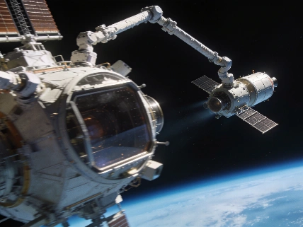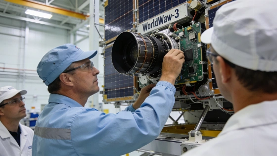
The WorldView-3 satellite, launched in 2014, delivered unprecedented high-resolution Earth imagery from orbit, enabling new research on methane emissions, land use, and archaeological sites using advanced remote sensing instruments
On August 13, 2014, the WorldView-3 satellite was launched from Vandenberg Air Force Base in California aboard a United Launch Alliance Atlas V rocket. Built and operated by DigitalGlobe, WorldView-3 was designed to deliver the highest-resolution commercial images of Earth's surface available at the time, with the ability to distinguish features as small as 31 centimeters. The satellite entered a sun-synchronous orbit, enabling frequent revisits and rapid data delivery for scientific, commercial, and environmental applications.
Instrument Capabilities
WorldView-3 is equipped with a suite of imaging sensors capable of capturing visible, near-infrared, and shortwave infrared data. Its primary instrument, a high-resolution camera, can resolve surface features down to approximately one foot, surpassing previous commercial satellites in detail. The satellite's sensors are also able to penetrate atmospheric obscurants such as fog and smoke, providing reliable imaging even under challenging conditions. This capability has proven valuable for monitoring dynamic events like wildfires and for mapping areas affected by haze or pollution.
In addition to its spatial resolution, WorldView-3 can rapidly assemble mosaic images and deliver processed data within hours of acquisition. The satellite's data pipeline includes automated algorithms for filtering, color correction, and compensation for atmospheric effects, ensuring that researchers receive consistent and scientifically useful imagery. These technical advances have made WorldView-3 a reference point for subsequent generations of commercial Earth observation satellites.
Scientific and Environmental Impact
The high-resolution data from WorldView-3 has enabled new research into environmental processes and human activity. One notable application is the detection and quantification of methane emissions from offshore oil and gas infrastructure. Methane is a potent greenhouse gas, and the ability to track its release from space has improved estimates of its contribution to climate change. WorldView-3's data has also been used to monitor deforestation, assess agricultural practices, and study the aftermath of natural disasters such as wildfires and floods.
Researchers have leveraged the satellite's near-infrared imaging to identify subtle changes in vegetation health and land cover, supporting conservation efforts and land management. The rapid revisit time and broad coverage have made it possible to track changes over days to weeks, providing a dynamic view of Earth's surface that complements other satellite datasets. These capabilities have contributed to a more detailed understanding of both natural and anthropogenic changes on the planet.
Unexpected Discoveries and Broader Context
Beyond environmental monitoring, WorldView-3 has played a role in archaeological research. In 2015, data from the satellite helped an international team identify what is believed to be a lost Viking settlement in Newfoundland, Canada. The discovery was made possible by analyzing near-infrared imagery, which revealed subtle soil and vegetation patterns consistent with human habitation. This finding marked only the second known Viking site in North America and demonstrated the potential of commercial satellite data for historical investigations.
The launch and operation of WorldView-3 also reflect a broader trend in commercial spaceflight, where private satellites increasingly contribute to scientific research. This shift parallels developments in other national programs, such as Japan's recent deployment of the Michibiki 7 navigation satellite, which expanded the country's Quasi-Zenith Satellite System and highlighted the growing role of commercial and governmental partnerships in space-based observation (see coverage of Japan's H3 rocket mission).
Limitations and Future Directions
While WorldView-3 set a new benchmark for commercial imaging, its data is not without limitations. The satellite's spatial resolution, though high, is still constrained by orbital altitude and sensor design, and atmospheric conditions can affect image quality despite advanced correction algorithms. Access to the highest-resolution data is also subject to regulatory restrictions in some regions, limiting its availability for certain applications.
Since WorldView-3's launch, newer satellites have entered service with improved sensors and expanded spectral coverage. However, the mission remains a critical reference for evaluating the capabilities and scientific value of commercial Earth observation platforms. Ongoing analysis of WorldView-3 data continues to inform research in climate science, land use, and remote sensing methodology.
Remote sensing satellites like WorldView-3 rely on a combination of optical and infrared sensors to capture detailed images of Earth's surface. The spatial resolution of a satellite image refers to the smallest object that can be distinguished, which for WorldView-3 is about 31 centimeters. Atmospheric effects such as clouds, haze, and aerosols can degrade image quality, so advanced processing algorithms are used to correct for these factors. Near-infrared and shortwave infrared bands are particularly useful for detecting vegetation health, water content, and certain minerals, making them valuable for both environmental monitoring and archaeological research. The ability to revisit the same location frequently allows for time-series analysis, revealing changes that would be missed by less frequent observations.