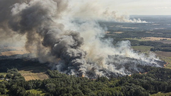
A NOAA-21 satellite image from July 14, 2026, reveals vast smoke plumes from over 850 wildfires in Canada, with thick haze drifting into the northeastern United States and raising air quality concerns across borders.
Smoke from hundreds of wildfires burning across Canada has been recorded in striking detail by the NOAA-21 satellite, with the resulting haze stretching from central Canada deep into the northeastern United States. The satellite's observations, made on July 14, 2026, provide a rare, continent-scale view of the atmospheric impact of these ongoing fires.
Satellite Image Reveals the Scale of the Smoke
The Visible Infrared Imaging Radiometer Suite (VIIRS) instrument aboard NOAA-21 captured extensive plumes of smoke originating primarily from northwestern Ontario. The image shows dense smoke blanketing large areas of southeastern Canada and trailing southward across the U.S. border, with visible effects as far as New York State. According to the Canadian Interagency Forest Fire Center, more than 850 wildfires are currently active, with many remaining uncontrolled in provinces including Manitoba, Saskatchewan, and Ontario.
Air quality has deteriorated sharply in affected regions. On July 16, New York State classified its air as “very unhealthy” and activated emergency protocols in response to the influx of wildfire smoke. The scale of the event has prompted comparisons to other large-scale environmental phenomena observed from space, such as the movement of glaciers across the Himalayas, which was documented in a previous satellite study.
How NOAA-21 Tracks Wildfire Plumes
NOAA-21's VIIRS instrument is designed to detect both visible and infrared wavelengths, enabling it to track smoke, aerosols, and other atmospheric features over wide areas. The July 14 image reveals not only the immediate extent of the smoke but also its transport pathways, with wisps reaching well into the United States. Most of the visible smoke in this observation is attributed to fires in northwestern Ontario, though additional sources are active across multiple provinces.
Beyond the immediate health and environmental impacts, the satellite data provide critical information for both emergency response and long-term climate research. Wildfire smoke contains fine particulate matter and a range of gases that can affect air quality, visibility, and even weather patterns. The ability to monitor these events from orbit allows scientists to assess the scale and movement of smoke plumes in near real time, supporting both public health advisories and atmospheric modeling efforts.
Wildfires, Air Quality and a Warming Climate
Researchers note that the frequency and intensity of wildfires in Canada have increased in recent years, a trend consistent with projections for a warming climate. Human-driven climate change, particularly through the continued use of fossil fuels, is expected to lengthen and intensify wildfire seasons in fire-prone regions. Satellite observations such as those from NOAA-21 are essential for documenting these changes and understanding their broader consequences.
On July 14, 2026, NOAA-21 recorded smoke from more than 850 active wildfires in Canada, with the densest plumes traced to northwestern Ontario. The VIIRS instrument's wide field of view enabled the detection of smoke transport across provincial and national borders, with significant haze observed over southeastern Canada and the northeastern United States. Emergency air quality measures were enacted in New York State as particulate concentrations reached hazardous levels.
How Satellite Wildfire Monitoring Works
Satellite-based monitoring of wildfires relies on the ability to detect both thermal signatures and atmospheric aerosols from orbit. Instruments like VIIRS use a combination of visible and infrared channels to distinguish smoke from clouds and surface features, enabling scientists to map the extent and movement of plumes over time.
These data are integrated with ground-based air quality measurements and meteorological models to assess health risks and predict future transport patterns. The accuracy of such monitoring depends on instrument calibration, atmospheric conditions, and the spatial resolution of the satellite imagery.