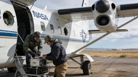
NASA is launching a new series of suborbital missions using aircraft, drones, and remote sensors to investigate wildfires, air quality, glacier retreat, and landslides, aiming to improve scientific understanding of rapid environmental change
NASA is set to begin a new phase of Earth science with six airborne campaigns designed to collect high-resolution data on some of the planet's most dynamic and hazardous processes. These suborbital missions, scheduled to start science flights this summer, will use a combination of aircraft, drones, and advanced sensors to address questions that cannot be answered by satellites alone. The projects will focus on phenomena ranging from wildfire-driven storm systems to glacier retreat and urban air pollution, with the goal of providing actionable information for researchers and communities.
Wildfire Storms and Airborne Sensing
The first of the new missions, the Injected Smoke and PYRocumulonimbus Experiment (INSPYRE), will target the towering "fire clouds" that form when intense wildfires generate their own thunderstorms. These pyrocumulonimbus events can inject smoke and particulates high into the atmosphere, disrupt aviation, and trigger additional fires through lightning. INSPYRE, led by the Naval Research Laboratory, will operate from Colorado and Montana, deploying NASA's high-altitude ER-2 aircraft equipped with a suite of remote sensing instruments. Among these are two advanced infrared wildfire trackers developed at NASA's Jet Propulsion Laboratory, which will contribute to the agency's FireSense program. The mission aims to capture real-time measurements of storm development, lightning activity, and smoke transport, providing data to improve forecasting models.
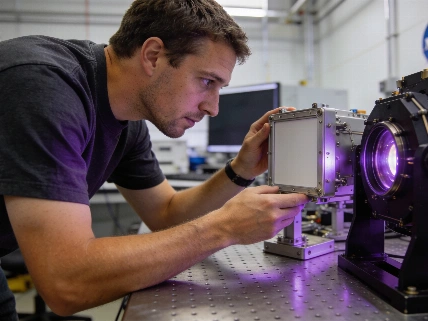
Airborne remote sensing bridges the gap between ground-based observations and satellite data. By flying at altitudes and locations inaccessible to satellites, these missions can resolve fine-scale features and rapidly evolving events. The use of multiple platforms-including planes, helicopters, drones, and balloons-enables scientists to collect complementary datasets that inform weather prediction, hazard assessment, and environmental management.
Tracking Pollution and Urban Air Quality
Another mission, FarmFlux, will investigate emissions from agricultural regions across the United States, focusing on pollutants such as ozone, methane, ammonia, and particulates. Led by NASA's Goddard Space Flight Center in partnership with Colorado State University and Boston University, FarmFlux will deploy more than a dozen sensors across the Midwest and California's Central Valley. The data will help quantify the impact of agricultural emissions on air quality, climate, and stratospheric ozone.
Urban air quality is also under scrutiny. The Hemispheric Airborne Measurements of Air Quality (HAMAQ) mission will compare pollution sources and atmospheric dynamics in Atlanta and Mexico City-two major cities with distinct air quality challenges. NASA's P-3B aircraft will fly low to directly sample pollutants, while the agency's recently modified 777 science jet will operate at higher altitudes, mapping pollution plumes with remote sensors. These coordinated flights are intended to test how satellite observations can be integrated with airborne and ground-based data to improve air quality forecasting and mitigation strategies.
Efforts to reduce launch costs and expand access to space have also influenced the design and deployment of airborne science platforms, as seen in the evolution of reusable launch vehicles discussed in recent aerospace engineering advances.
Rapid Change in the Arctic
As the Arctic warms at more than twice the global average rate, two missions will focus on the region's rapidly transforming landscapes. The Snow4Flow campaign, led by the University of Arizona, will use a modernized World War II-era aircraft equipped with a scanning laser altimeter and custom radar systems to survey glaciers across Alaska, the Yukon, Arctic Canada, Greenland, and Svalbard. By combining airborne measurements with satellite data and advanced models, Snow4Flow seeks to quantify glacier retreat and understand the processes driving ice loss and sea level rise.
The Frontlines of Rapidly Transforming Ecosystems (FORTE) project, led by NASA Goddard and the City College of New York, will study how thawing permafrost and changing river systems affect carbon and sediment transport into the Arctic Ocean. The team will integrate data from satellites, aircraft, research vessels, drones, and underwater autonomous systems to monitor water chemistry, microscopic life, and ecosystem change. Collaboration with local and tribal communities is central to sustaining long-term observations and addressing emerging environmental risks.
Landslide Hazards and Mission Context
The Landslide Change Characterization Experiment (LACCE), led by NASA's Jet Propulsion Laboratory, will combine airborne synthetic aperture radar with ground-based sensors to monitor slope stability in California and Alaska. The project aims to understand how precipitation extremes and glacier retreat influence landslide risk, including the potential for large-scale events capable of generating tsunamis. By tracking changes in slope movement and water infiltration, LACCE will provide data to improve hazard assessment and early warning systems.
NASA's Earth Venture Suborbital program, established in response to a 2007 National Research Council recommendation, is designed to support nimble, high-impact investigations that complement satellite missions. Previous campaigns have addressed topics from blizzards to coral reefs, demonstrating the value of targeted airborne observations for advancing Earth science. The current suite of missions will mobilize hundreds of scientists, pilots, and engineers from NASA, the U.S. Navy, universities, and partner institutions over the next several years.
Remote sensing is the practice of collecting data about Earth's surface and atmosphere from a distance, typically using instruments mounted on satellites or aircraft. Airborne remote sensing offers higher spatial and temporal resolution than most satellite systems, allowing scientists to observe rapid changes and small-scale features. Instruments such as lidar (light detection and ranging), radar, and multispectral imagers convert reflected or emitted energy into digital data, which are then processed to map physical properties, track movement, or detect chemical signatures. The integration of airborne, satellite, and ground-based measurements is essential for building accurate models of environmental processes and improving forecasts of natural hazards.