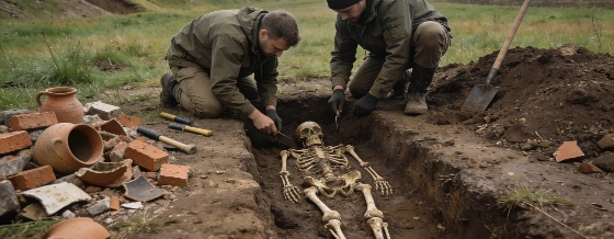
Archaeologists have identified the site of the lost medieval settlement of Nyénye near Szolnok, Hungary, by excavating graves, pottery, and building debris. The findings clarify the village's location and burial practices, but key uncertainties remain
Archaeological excavations on the southern outskirts of Szandaszőlős, near Szolnok in central Hungary, have provided the first secure evidence for the location of Nyénye, a medieval settlement previously known only from historical records. The investigation, led by the Damjanich János Museum and commissioned by Hungary's National Archaeological Institute, focused on a site where surface finds of pottery suggested the presence of a buried settlement dating to the 15th and 16th centuries CE.
Excavation and Material Evidence
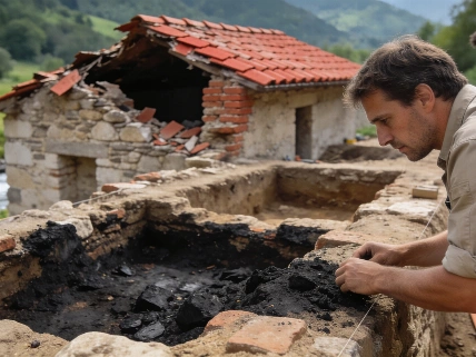
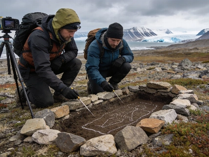
Researchers opened four exploratory trenches, uncovering ditches, pits, and substantial quantities of pottery fragments. These features indicated a once-inhabited village rather than a scattered or isolated occupation. The most significant discovery was a group of graves, which were not immediately visible in the soil but became apparent through careful excavation. The graves were aligned west to east, with the heads of the deceased to the west, a pattern consistent with Christian burial practices in medieval Europe.
In one trench, archaeologists identified three graves, all lacking grave goods. The absence of objects is typical for medieval churchyard burials in the region, where only occasional clothing accessories are preserved. The graves' orientation and spatial relationship suggested they formed part of a cemetery surrounding a church, a hypothesis supported by a dense concentration of stone and brick rubble nearby. Although the church structure itself lies outside the current excavation area, the distribution of building debris points to its probable location north of the excavated graves.
Burial Practices and Cemetery Use
Analysis of the burial context revealed that the cemetery was used intensively over time. In two cases, later graves had been dug into earlier burials, with the bones of previously interred individuals displaced to accommodate new burials. Such overlapping is not unusual in medieval cemeteries, especially where burial space was limited and churchyards served generations of local residents. The current excavation has exposed only a small portion of the cemetery, and further graves are likely to be present in the unexcavated area.
Pottery fragments recovered from the site, along with the stratigraphic context of the graves and associated features, support a date in the late medieval period. The settlement is last mentioned in written records in 1548 CE, after which it disappears from historical documentation. The combination of archaeological and documentary evidence has allowed researchers to move beyond previous approximations and identify the site with the lost village of Nyénye.
Historical Records and Site Identification
To confirm the identification, researchers compared the archaeological findings with medieval charters and property records referencing Nyénye and neighboring settlements. The spatial relationship between the excavated remains and the descriptions in historical documents provided a strong basis for associating the site with the lost village. This approach mirrors recent work at other medieval sites, such as the reinterpretation of Galich's fortified settlements, where archaeological and documentary sources were combined to clarify site chronology and function (see analysis of Galich fortress evidence).
The current investigation remains preliminary, with only a limited area excavated and a small number of graves analyzed. The preservation of skeletal material and associated artifacts is variable, and no direct radiocarbon dating has yet been reported. Future work may expand the excavation to include the probable church site and a larger sample of burials, which could provide further insight into the community's demography, health, and mortuary practices.
Archaeological Context and Limitations
The identification of Nyénye's location is based on the convergence of material evidence-graves, pottery, and building rubble-with historical documentation. However, the absence of grave goods and the limited sample size restrict the interpretation of social status, health, and population structure. The overlapping burials demonstrate cemetery crowding but do not establish the duration or intensity of use without further chronological analysis. The church's precise layout and construction remain unexcavated, and the full extent of the settlement is not yet defined.
As with many medieval rural sites, the archaeological record is shaped by centuries of agricultural activity, erosion, and modern development. The preservation of human remains and associated features is uneven, and the potential for future discoveries depends on both excavation strategy and site protection. The integration of written sources with archaeological data provides a model for reconstructing lost settlements, but the evidence must be interpreted within its preservation and sampling limits.
In medieval archaeology, the identification of a settlement often relies on the combined use of material evidence and historical records. Pottery typology, burial orientation, and building debris can indicate the presence and character of a site, but written sources are essential for linking archaeological remains to named communities. The reliability of such identifications depends on the quality of both the archaeological context and the documentary record, as well as the ability to correlate spatial and chronological information across disciplines.