Archaeologists in Galicia are studying a large engraved rock that may show the floor plan of a prehistoric hut. The find, set among burial mounds and shelters, could change how researchers view ritual and domestic space in northwest Iberia.
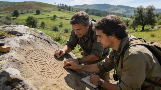
In the hills of Lugo, Galicia, archaeologists are taking a closer look at a carved rock surface that could shed light on how prehistoric communities shaped and moved through their surroundings. The engraving, which covers about 40 square meters, is thought to outline the base of a hut-a rare subject in European rock art. This detail hints at a more complex relationship between daily life and ritual space than previously recognized. The fourth archaeological campaign at Santa María Madalena de Adai began on August 31, 2026, and will run through September 18, focusing on two rock shelters in Penas do Caldeiro, including the site known as Pena Travesa.
The current work is part of a multi-year project at Santa María Madalena de Adai, led by researchers from the University of Santiago de Compostela (USC) and CISPAC. Since August 2026, the team has concentrated on two rock shelters at Penas do Caldeiro, with special attention to the engraved surface at Pena Travesa. Here, they have documented cup-shaped depressions and the large hut-like motif using non-invasive techniques and detailed mapping. This campaign builds on earlier fieldwork from 2023 to 2025 in Corro dos Mouros, aiming to clarify how burial mounds, rock shelters, and other features relate to each other in the landscape.
Beyond the main petroglyph, the team has identified six new burial mounds (mámoas) and two more engraved rocks nearby, adding to the known cluster of prehistoric sites in the Adai area. This growing list highlights the region's importance for understanding how funerary, domestic, and ritual practices overlapped in northwest Iberia. The researchers are using systematic surface surveys, photogrammetry, and plan to add geophysical prospection, following methods recommended by groups like the Max Planck Society and the European Association of Archaeologists.
The scale and geometric shape of the engraving set it apart from most Iberian rock art, which usually features abstract designs or cup marks. Archaeologists suggest the motif may show the base of a prehistoric hut, but other explanations are possible since no direct architectural remains have been found. Its unusual character in the European context has led to comparisons with other large enclosures and settlement markers, though the only evidence for its purpose is the engraving itself and its setting. Project lead Professor Pilar Prieto (USC/CISPAC) notes that the find could "complete the knowledge of a sacred landscape," and the team is looking for possible subsurface structures that might clarify what the motif represents.
The researchers stress that the petroglyph should be seen in context. Its location among burial monuments and shelters suggests that domestic and ritual spaces may have overlapped or been symbolically connected. This approach is similar to recent studies of Neolithic enclosures elsewhere in Europe, such as the Baalberge monument near Leipzig, where large-scale architecture and selective burial have been linked to complex social organization. Peer-reviewed studies in journals like Nature have shown that analyzing the broader landscape is key to understanding prehistoric monuments.
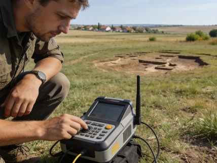
To look beneath the surface, the team plans to carry out geophysical surveys at the end of September. These non-destructive methods, including ground-penetrating radar (GPR) and magnetometry, can help detect buried structures or features that might connect the known monuments. Any findings could guide future excavations and help determine whether the engraved motif matches an actual building or is purely symbolic. GPR has been used in many international archaeology projects, including those supported by NASA's Jet Propulsion Laboratory for heritage science.
Still, the interpretation of the petroglyph is tentative. Without artifacts, datable material, or preserved building remains, its age and function remain uncertain. The team acknowledges that the motif's uniqueness could reflect a local tradition or even a single individual's act, rather than a widespread practice. The project also includes public outreach, with a guided tour scheduled for September 17 at 17:00, part of a broader effort to make archaeological research more accessible.
The larger goal of the Adai project is to piece together how prehistoric people navigated, changed, and gave meaning to their environment. The clustering of cairns, shelters, and engraved rocks points to a landscape shaped by both practical needs and symbolic choices. The discovery of new sites during this campaign shows how much remains unknown and the potential for further finds in the region. For comparison, a Science journal article has discussed how spatial analysis of prehistoric monuments can reveal patterns of ritual and domestic activity across Europe.
While the engraved hut plan stands out for its size and shape, its meaning depends on context that is still being uncovered. So far, the evidence suggests that prehistoric communities in northwest Iberia created and maintained sacred landscapes where domestic, funerary, and ritual elements came together. But without direct dating and with the motif's purpose still unclear, any claims of uniqueness should be made with caution. The Adai petroglyph is a reminder that prehistoric monuments often defy simple explanations, and that careful analysis of their context is essential for understanding the traces left by past lives.
Ground-penetrating radar (GPR) is a geophysical tool that sends electromagnetic pulses into the ground and measures the reflected signals to detect subsurface features. In archaeology, GPR can reveal buried walls, ditches, graves, or other structures without digging. However, its effectiveness depends on soil conditions, depth, and the contrast between archaeological features and the surrounding ground. GPR results need to be interpreted alongside excavation and other survey data, since not all anomalies are caused by human activity, and some archaeological features may not show up in the scans.