Aerial laser scanning has revealed nearly 400 previously unknown earthworks beneath the Amazon rainforest canopy, offering new evidence for the scale and organization of the Aquiry society that flourished in western Brazil over two millennia ago
Recent research using airborne LiDAR (Light Detection and Ranging) has identified hundreds of previously undocumented earthworks, or geoglyphs, beneath the dense forest cover of the southwestern Amazon. These geometric features, constructed by the Aquiry society between approximately 600 BCE and 850 CE, provide new insight into the complexity and extent of precolonial settlement in the region.
Surveying the Amazon Landscape
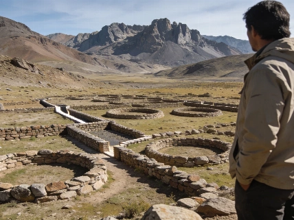
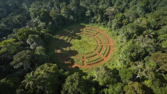
The study, published in Nature, analyzed LiDAR data covering nearly 4,500 square kilometers of rainforest in Brazil's Acre and Amazonas states. Researchers detected 396 new geoglyphs, adding to the roughly 1,700 previously known in the region. These earthworks, characterized by deep ditches and raised embankments forming circles, squares, and other geometric shapes, are interpreted as ceremonial centers rather than defensive structures or simple habitation sites.
The Aquiry society, named after the Acre River and first formally described in 2021, appears to have been a network of communities sharing architectural traditions and a common worldview. The geoglyphs are distributed across a wide area, suggesting a high degree of social coordination and landscape modification. Most sites are located on elevated ground above floodplains, with evidence of surrounding longhouse settlements and agricultural activity, including the cultivation of maize and squash.
Population and Chronology
Based on the density and distribution of geoglyphs, the research team estimates that the Aquiry population may have reached between 1.25 and 3 million people at its peak, although these figures remain provisional. The construction of each geoglyph likely required the labor of hundreds of individuals, indicating substantial community organization. Radiocarbon dating and contextual analysis place the main period of earthwork construction between 600 BCE and 850 CE, with abandonment occurring rapidly between 850 and 950 CE for reasons that remain unclear.
Comparative evidence from other regions, such as the Nazca Lines of Peru, demonstrates that large-scale geoglyph construction was not unique to the Amazon, but the Aquiry earthworks are distinct in their form, function, and environmental context. While the Nazca Lines are famous for animal and human motifs, the Amazonian geoglyphs are primarily geometric and are best appreciated from the air, a perspective only recently made possible by remote sensing technology.
Remote Sensing and Archaeological Interpretation
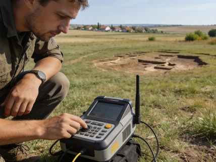
LiDAR has transformed the study of Amazonian archaeology by allowing researchers to digitally remove vegetation and reveal subtle topographic features invisible from the ground. The identification of nearly 400 new geoglyphs in a single survey area suggests that thousands more may remain undiscovered across the southwestern Amazon. However, the interpretation of these features depends on ground verification and careful contextual analysis, as not all anomalies detected by LiDAR correspond to archaeological sites.
Most of the evidence for the Aquiry society comes from remote sensing and limited excavation, as the dense forest and challenging preservation conditions restrict traditional archaeological investigation. The geoglyphs themselves do not contain direct evidence of their builders' identities, beliefs, or social organization, and no written records survive. Oral traditions among Indigenous Arawakan-speaking communities suggest that these centers played roles in intercommunity relations and ceremonial gatherings, but the precise meanings and functions remain debated.
Collapse and Uncertainty
The sudden abandonment of the geoglyphs between 850 and 950 CE is not yet fully understood. Researchers propose that environmental, social, or political factors may have contributed, possibly in connection with broader regional changes affecting other precolonial societies such as the Classic Maya and the Tiwanaku and Wari in the Andes. The lack of direct evidence for conflict or environmental catastrophe leaves the causes of collapse open to further investigation.
Recent advances in isotopic analysis have also contributed to understanding ancient Amazonian subsistence. For example, stable isotope studies in Brazil's Cerrado region have shown that some precolonial communities practiced maize-based polyculture, challenging assumptions about Indigenous diets in tropical South America (see this related research). Such findings highlight the diversity and adaptability of ancient Amazonian societies.
The discovery of extensive geoglyph networks in the Amazon underscores the need for further interdisciplinary research, combining remote sensing, excavation, paleoenvironmental reconstruction, and collaboration with Indigenous communities to build a more complete picture of precolonial life in the region.
LiDAR, or Light Detection and Ranging, is a remote sensing technique that uses laser pulses emitted from aircraft to measure ground elevation with high precision. In heavily forested environments like the Amazon, LiDAR can digitally filter out vegetation, revealing subtle archaeological features such as earthworks, mounds, and ancient roads. While LiDAR provides a powerful tool for mapping and discovery, its results must be interpreted cautiously, as not all detected features are of human origin. Ground verification and integration with other archaeological methods remain essential for confirming the nature and significance of remote-sensed anomalies.