A new study reinterprets two large stone structures near the Red Pyramid at Dahshur as ancient dams, not ramps, using satellite imagery and hydrological modeling to propose a sophisticated water management system over 4,500 years ago
Two monumental stone structures west of Egypt's Red Pyramid at Dahshur, long thought to be construction ramps, have been reexamined by researchers who now suggest they may be the remains of ancient dams. The study, published in npj Heritage Science, combines satellite imagery, watershed mapping, and hydrological modeling to argue that these features were designed to control seasonal floodwaters more than 4,500 years ago, during the reign of Pharaoh Sneferu.
Reinterpreting Monumental Stonework
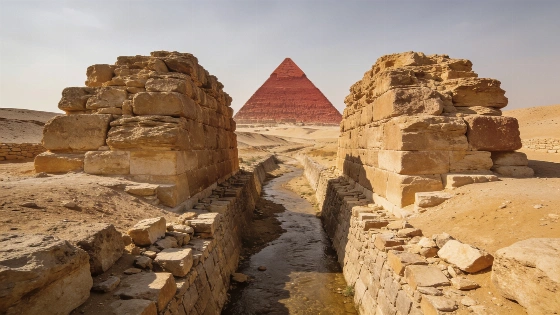
The two structures, each extending between 600 and 700 meters across Wadi Dahshur, are anchored into the valley's hillsides. Their scale and configuration, the authors argue, are more consistent with hydraulic engineering than with the transport of building materials. The eastern structure is interpreted as a primary dam, likely intended to retain floodwaters, while the western structure may have functioned as a secondary check dam. The presence of a duckbill-shaped weir suggests a system for sediment trapping and water regulation, channeling flow into a diversion channel west of the Red Pyramid.
Hydrological analysis indicates that Wadi Dahshur was connected to tributaries of Wadi Taflah, providing a catchment area of at least 100 square kilometers, and possibly up to 400 square kilometers. This would have enabled the system to manage significant volumes of water, potentially supporting construction activities or local agriculture during the Old Kingdom.
Evidence and Alternative Interpretations
The structures' function remains a subject of debate. Previous interpretations identified them as ramps for transporting stone blocks to the Red Pyramid, the first successfully completed smooth-sided pyramid in Egypt. However, the new analysis highlights engineering features-such as anchoring into bedrock and the presence of water-control elements-that are not typical of transport ramps. The study's authors emphasize that further archaeological investigation, including excavation and fieldwork, will be necessary to confirm the dams' purpose and establish their precise date of construction.
While the proximity of the dams to the Red Pyramid raises the possibility of a direct connection to pyramid construction, the evidence does not yet establish whether the water management system was built specifically for this purpose or served broader landscape needs. The research represents an initial interpretation based on remote sensing and landscape analysis, and the authors caution that additional field evidence is required.
Numerical Context and Broader Implications
The two stone structures each span 600-700 meters across the valley, with the potential catchment area for the proposed hydraulic system estimated at a minimum of 100 square kilometers and possibly as much as 400 square kilometers. These dimensions suggest a scale of water management infrastructure not previously documented for the Old Kingdom period. If confirmed, the findings would expand current understanding of ancient Egyptian engineering, indicating that large-scale hydraulic projects may have played a role in supporting monumental construction and local resource management.
Comparative research into ancient water management systems, such as the study of organic preservation in Mediterranean necropoleis, has highlighted the diversity of environmental adaptation strategies in early complex societies. For example, investigations into burial practices and imported grave goods in southern Italy have provided insight into how communities responded to local conditions and resource availability, as discussed in this recent analysis of an archaic necropolis in Italy.
Remote Sensing in Archaeological Research
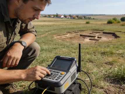
Remote sensing techniques, including satellite imagery and hydrological modeling, have become increasingly important in archaeological landscape analysis. These methods allow researchers to identify large-scale features and reconstruct ancient environmental conditions without immediate excavation. However, remote sensing results must be interpreted cautiously, as surface features may not always correspond to subsurface archaeological remains. Ground verification and targeted excavation remain essential for confirming the function, date, and construction sequence of proposed hydraulic structures.
In the case of the Dahshur dams, the integration of remote sensing with hydrological analysis has generated a new hypothesis about ancient Egyptian water management, but the absence of direct archaeological excavation means that the interpretation remains provisional. The study underscores the value of interdisciplinary approaches while highlighting the need for further fieldwork to resolve outstanding questions about the monuments' origins and use.
Hydrological modeling is a computational method used to simulate the movement and distribution of water across landscapes. In archaeological research, it helps estimate how ancient structures may have interacted with seasonal floods, catchment areas, and water flow. By combining topographic data with environmental variables, researchers can reconstruct past hydrological conditions and assess the plausibility of proposed water management systems. However, these models depend on assumptions about ancient climate, land use, and construction details, and their results must be tested against physical evidence from excavation and field survey.