NASA has released the original images captured by Viking 1 after its 1976 Mars landing, offering a detailed look at the Red Planet's surface and the mission's scientific legacy
Fifty years after Viking 1 transmitted the first image from the surface of Mars, NASA has re-examined the historic data, providing new context for one of planetary science's most significant milestones. The Viking 1 lander, which touched down on July 20, 1976, delivered humanity's initial direct view of another planet's surface, marking a turning point in Mars exploration and planetary imaging.
Viking 1's Landing and Imaging Sequence
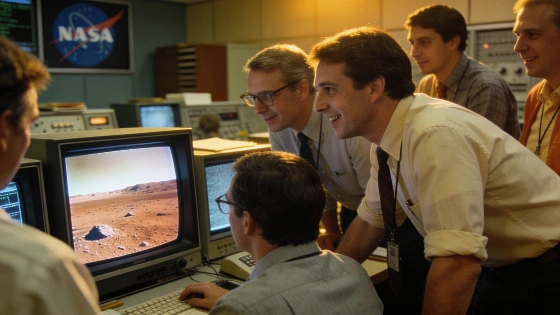
Viking 1 was programmed to begin imaging within seconds of landing at Chryse Planitia, a broad plain north of Mars's equator. The spacecraft's first image was scheduled to be taken just 25 seconds after touchdown, but mission controllers had to wait for the radio signal to traverse the vast distance between Mars and Earth. The signal confirming a safe landing arrived 19 minutes later, after crossing approximately 212 million miles (340 million kilometers). The first image, a grayscale scan of the rocky Martian surface and one of the lander's footpads, began to appear on monitors at NASA's Jet Propulsion Laboratory about 40 minutes after landing, building line by line as data arrived.
The Viking 1 mission had originally targeted a landing on July 4, 1976, to coincide with the U.S. Bicentennial, but the search for a suitable, flat landing site delayed the descent by more than two weeks. The successful touchdown and subsequent imaging established a new standard for planetary surface exploration, providing direct visual evidence of Mars's terrain and surface composition.
Surface Features and Early Scientific Results
The initial images revealed a stable, slightly rocky surface with scattered dust and pebbles, some of which had been disturbed by the lander's descent. The clarity of the images allowed scientists to assess the immediate environment and plan subsequent experiments. Viking 1's imaging system soon delivered the first color photograph from the Martian surface, followed by panoramic mosaics that mapped the surrounding landscape in unprecedented detail.
Viking 1 was joined on the surface by Viking 2 six weeks later, while two orbiters mapped Mars from above. Together, the Viking landers and orbiters returned more than 52,000 orbital images and 4,500 surface photographs, dramatically expanding knowledge of Martian geology and atmospheric conditions. The mission's scientific payload included the first experiments designed to detect life directly in Martian soil, though the results remain debated. While the official conclusion was that no convincing evidence of life was found, some researchers have argued that one experiment may have produced a biological signal, while others suggest the tests could have destroyed potential biosignatures.
Mission Legacy and Ongoing Questions
Viking 1 operated on the Martian surface until 1982, when a software error ended communications. Its data continue to inform planetary science, especially as new missions revisit the question of Martian habitability. Later discoveries, such as the detection of organic molecules by the Curiosity rover and perchlorate salts by the Phoenix lander, have prompted renewed analysis of Viking's results. The debate over whether Viking 1 detected signs of life remains unresolved, highlighting the complexity of interpreting in situ measurements on another planet.
The Viking mission's approach to surface imaging and sample analysis set a precedent for subsequent Mars landers and rovers. Its legacy is evident in the design and operation of later missions, including those that have used Mars flybys for trajectory adjustments, such as the Psyche spacecraft's recent maneuver described in this related report.
Technical Milestones and Data Transmission
The Viking mission's imaging system relied on a slow-scan camera that built up images line by line, a process dictated by the limited bandwidth available for deep-space communication in the 1970s. Each image required careful planning and significant transmission time, with data relayed through the orbiters before reaching Earth. The mission's ability to return high-quality images over interplanetary distances was a technical achievement that shaped expectations for future planetary exploration.
Viking's data transmission and imaging protocols influenced the development of later Mars missions, which now routinely deliver high-resolution color images and multispectral data. The mission's experience with communication delays, data rates, and surface operations remains relevant as new spacecraft are designed for more complex scientific objectives on Mars and beyond.
Imaging from planetary surfaces involves converting analog or digital signals from a camera into data packets that can be transmitted across millions of kilometers. Early missions like Viking 1 used slow-scan television systems, which produced images by scanning the scene line by line and encoding the brightness values for each pixel. These data were then sent to Earth via radio, where ground-based computers reconstructed the image. Modern missions use advanced digital cameras and higher-bandwidth communication systems, but the fundamental challenge of transmitting large volumes of data across interplanetary distances remains. Understanding these technical constraints is essential for interpreting the quality and timing of images returned from planetary missions.