NASA's CSDA program has released a technical assessment of the Polar Geospatial Center's EarthDEM elevation models, evaluating their suitability for Earth science research using airborne lidar comparisons
NASA's Commercial Satellite Data Acquisition (CSDA) program has published a detailed assessment of the Polar Geospatial Center's EarthDEM elevation products, focusing on their accuracy and documentation for scientific use. The evaluation, released on August 8, 2026, addresses how well these digital elevation models (DEMs) meet the needs of Earth science research and applications.
Assessment of EarthDEM Products
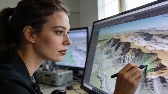
The CSDA report examines two primary EarthDEM products: the "Mosaic Tile" and "Strip" Digital Surface Models (DSMs). Both datasets are derived from optical satellite imagery collected by the Vantor (formerly Maxar) fleet, though the report notes that EarthDEM is not technically a commercial product. NASA's subject matter experts assessed the horizontal and vertical accuracy of these models by comparing them to airborne lidar data collected over diverse terrain in the United States and Senegal.
Results indicate that the horizontal accuracy of the EarthDEM Strip DSM (0.5 meters Root Mean Square Error Horizontal, RMSEH) and Mosaic Tile (0.3 meters RMSEH) aligns with the Polar Geospatial Center's published specifications, earning an "Excellent" rating. However, vertical accuracy was more variable. The Strip DSM showed a vertical RMSE ranging from 4.6 to 6.8 meters depending on cloud cover metadata, while the Mosaic Tile achieved 4.9 meters RMSEV. Both values exceed the PGC's stated specification of 0.5 meters RMSEV, leading the report to grade vertical accuracy as "Basic."
Implications for Earth Science Research
The assessment concludes that EarthDEM data can support NASA Earth science research, provided users account for the products' vertical accuracy limits, cloud masking challenges, and occasional data voids. The report emphasizes that the suitability of EarthDEM depends on the specific scientific objectives and the required precision for each application. For studies where high vertical accuracy is critical, researchers may need to supplement EarthDEM with alternative datasets or apply additional corrections.
In addition to accuracy testing, the report includes a review of EarthDEM's documentation. Most technical information is available through the product's user guide, peer-reviewed publications, and the PGC GitHub repository. The documentation is described as "well documented," though the evaluation only considered sources listed in the report.
CSDA Program and Data Access
The CSDA program was established to identify, evaluate, and acquire commercial satellite data that can advance NASA's Earth science goals. By systematically assessing datasets like EarthDEM, CSDA aims to inform both NASA management and the broader research community about the strengths and limitations of commercially sourced geospatial data. This approach is intended to complement NASA's own observations and those of its partners, offering a cost-effective means to expand scientific data coverage.
For those interested in the full technical details, the complete assessment and related documentation are available through the Polar Geospatial Center's vendor page on the CSDA website. The program's broader efforts to expand access to space science data are part of a larger trend, as seen in NASA's initiatives to increase student participation in mission activities, highlighted in a recent article on expanding student access to space missions and STEM careers.
Limitations and Future Considerations
While the EarthDEM products provide valuable elevation data for many applications, the report underscores the importance of understanding their limitations. Vertical accuracy varies with land cover and cloud conditions, and some surface features may be missing or poorly resolved. Users are advised to review the metadata and documentation carefully before integrating EarthDEM into critical analyses. Ongoing improvements in satellite imaging and processing may address some of these challenges in future releases.
EarthDEM's status as a dataset derived from commercial satellite imagery, rather than a direct commercial product, also shapes its role in the broader landscape of geospatial data. As the demand for high-resolution elevation models grows, transparent assessments like this one will remain essential for guiding scientific and operational use.
Digital elevation models (DEMs) are gridded datasets representing the height of Earth's surface, constructed from remote sensing data such as satellite imagery or airborne lidar. Horizontal accuracy refers to how closely the mapped positions match real-world locations, while vertical accuracy measures the difference between reported and actual elevations. Root Mean Square Error (RMSE) is a standard metric for quantifying these differences. DEM quality can be affected by factors including sensor resolution, atmospheric conditions, surface cover, and data processing methods. Understanding these parameters is crucial for researchers who rely on elevation data for modeling terrain, hydrology, and environmental change.