Archaeologists in Burgundy have uncovered deep, stratified remains on Montbellant hill, documenting the transformation from a Gallic oppidum to a medieval town through successive building phases and industrial activity
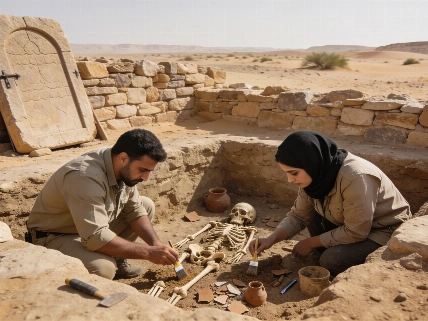
Recent excavations on Montbellant hill in Tonnerre, northern Burgundy, have exposed a complex archaeological sequence that traces the evolution of settlement from the late Iron Age through the medieval period. Conducted by France's National Institute for Preventive Archaeological Research (Inrap), the investigation covers a 750-square-meter area ahead of planned construction, revealing more than two meters of stratified deposits in some locations. These layers preserve evidence of occupation spanning over 1,500 years, offering a rare opportunity to study long-term settlement continuity and transformation in a single location.
Stratified Remains and Medieval Architecture
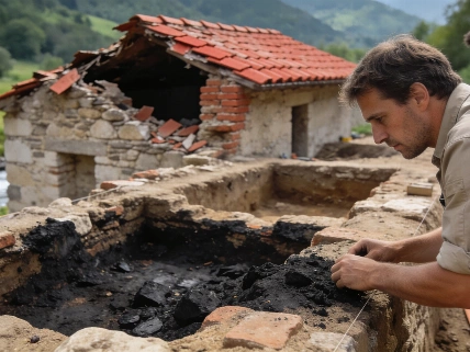
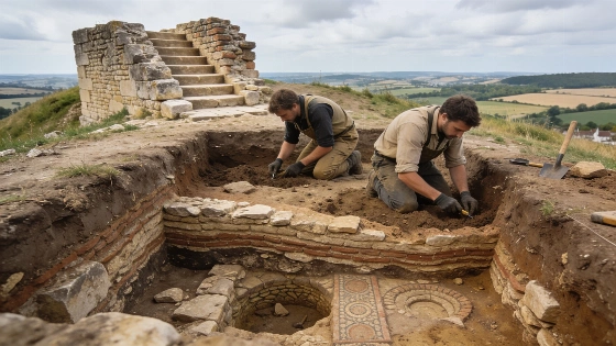
The uppermost layers of the site correspond to the later Middle Ages, representing the final phase of intensive occupation on the summit. Archaeologists have identified numerous pits and cut features from this period, some of which disturb or remove earlier remains. Among the most substantial discoveries is a large medieval building at the edge of the excavation, likely dating to the middle medieval period. This structure contains several rooms, including a cellar partly carved into the limestone bedrock and accessed by a stone staircase. The cellar was intentionally filled during the Middle Ages, but its construction cuts through earlier features, illustrating the site's complex sequence of building, modification, and abandonment.
Another room within the same building revealed a partially excavated vaulted entrance facing the valley. At some point, this entrance collapsed into an older pit beneath it, causing part of the masonry and vault to subside. Archaeologists recovered wedge-shaped stones from the arch and an iron fitting that likely secured a wooden door, providing insight into medieval construction techniques and site reuse.
Roman and Gallic Occupation Layers
Beneath the medieval structures, the team has begun to uncover remains from the Roman period. Several buildings with surviving wall sections and associated courtyard surfaces have been identified, although later construction has damaged or obscured parts of these features. The widespread presence of metallurgical slag fragments suggests that metalworking took place on the hill during this era, possibly in a nearby workshop. The density of structures, even along steep slopes, indicates that space was limited and occupation was carefully organized.
Deeper still, evidence of a structured Gallic settlement dating to the first century BCE has been found. Despite disturbance from later building, pits and other features survive, along with pottery and coins confirming pre-Roman occupation. These findings support interpretations from a nearby 2024 excavation, reinforcing the view that Montbellant hill was a long-lived settlement center rather than a series of unrelated occupations. The archaeological sequence demonstrates repeated redevelopment, with Roman and medieval structures built over or through earlier remains.
Settlement Transformation and Research Context
The Montbellant excavation is significant for understanding the early urban development of Tonnerre. The depth and complexity of the deposits require careful, layer-by-layer excavation to reconstruct the site's history. As archaeologists progress downward, they expect to clarify how buildings, streets, and industrial activities changed over time. The site's stratigraphy allows researchers to compare occupation phases and assess how settlement density, organization, and function evolved from the Iron Age through the Middle Ages.
In total, the excavation covers approximately 750 square meters and reaches depths exceeding two meters in some areas. The proximity to a previous 2024 investigation, which also documented the transition from Gallic oppidum to medieval town, enables comparative analysis of neighboring sectors. This approach mirrors research strategies used at other fortified settlements, such as those discussed in the context of Galich, where recent reinterpretation of fortification phases has challenged established chronologies.
The Montbellant site will be opened to the public in September 2026, providing a rare opportunity to observe the excavation process and the exposed layers of Tonnerre's past. For archaeologists, the site offers a densely layered record of settlement transformation, industrial activity, and architectural adaptation over more than a millennium.
Understanding the sequence of occupation at Montbellant relies on stratigraphy-the study of layered deposits formed by successive human activity and natural processes. Each layer, or stratum, represents a distinct phase of use, abandonment, or modification. By excavating these layers in reverse order of deposition, archaeologists can reconstruct the relative chronology of structures and features, identify episodes of disturbance or reuse, and link material evidence to specific periods. Stratigraphic analysis is essential for interpreting complex sites where centuries of building, demolition, and infilling have created a palimpsest of human activity.