Curiosity has photographed millimeter-scale disc-shaped features on Martian bedrock and is preparing a drill campaign to determine whether they formed from minerals or fragments of harder rock
Curiosity's next drill site is being chosen beside a geological puzzle: bedrock covered with small disc-shaped features unlike the finely layered rocks that have dominated the rover's recent work. The rover has imaged the forms in detail, but their identity is not yet known. They may reflect the growth habit of a crystalline mineral or the accumulation of tougher rock fragments.
NASA encountered the change in a sulfate-unit workspace on Mount Sharp. Instead of smooth or finely stratified blocks, the rover found surfaces crowded with roughly disc-shaped lumps that may also extend into the rock. Similar disc-like textures were seen earlier in the Murray mudstones near Pahrump Hills, and comparable textures occur in some terrestrial rocks where minerals precipitate from evaporating fluids.
That comparison is useful but not decisive. A mineral that grows in a characteristic shape would point toward a chemical history involving fluids and changing conditions. A layer of harder material that fractured and collected in one place would describe a different process. The images establish morphology, not composition or origin. Independent reports published in late September described the features as broader and shallower marks or cavities than earlier examples, without obvious attached objects, reinforcing the need for additional measurements rather than a visual conclusion.
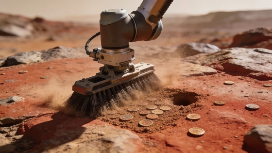
Curiosity brushed the bedrock informally named "Salar de Vacas" with its Dust Removal Tool before acquiring a close-up view with the Mars Hand Lens Imager, or MAHLI. Mounted on the rover's robotic-arm turret, MAHLI uses images taken at different focus positions to build a composite in which as many surface features as possible are sharp. This approach lets planetary geologists examine textures that are too small to resolve reliably from orbit.
The resulting image shows a jumble of disc-like forms alongside the divot made by brushing. Each feature is about 3-4 millimeters across and roughly 1 millimeter thick. Curiosity completed the focus merge at 02:14:02 UTC on Sept. 16, 2026, Sol 5016 of the Mars Science Laboratory mission. The scale matters: these are hand-lens-sized structures, not broad landforms that can be interpreted from orbital imagery alone.
Images will be paired with chemistry. The rover planned Mastcam and MAHLI observations of the jumbled blocks called "Yungay" and "Chiu Chiu," while its Chemistry and Camera instrument was assigned laser-induced breakdown spectroscopy targets named "Puya Raimondii," "Liolaemus Tacnae," and "Pisqu Warkatana." The Alpha Particle X-ray Spectrometer was directed at "Salar de Vacas." Together, these instruments can compare visible texture with elemental and surface-chemical patterns, although they cannot by themselves settle every question about the minerals' internal crystal structures.
Those measurements can identify elemental patterns and surface chemistry, but Curiosity needs its CheMin X-ray diffraction instrument to determine which crystalline minerals are present. X-ray diffraction reads the regular atomic structure of mineral grains, making it more discriminating than an image or a surface elemental measurement. NASA describes this kind of instrument complement as a division of labor: cameras reveal texture, spectrometers assess chemistry, and diffraction tests mineral phases.
Curiosity has driven more than 1 kilometer since its last drill site at Campo Marte. The planned target will be the rover's first drill location above the erosional supersurface. After a short positioning drive, the team planned contact science with the arm instruments, including work associated with "Alberta Wild Rose" and "Moonraker Mountain," followed by additional observations from ChemCam and Mastcam at "Osoyoos," "Trincomali Channel," and "Yellow Lady's Slipper." A concise NASA mission overview provides broader context on the rover's instrument-led exploration strategy.
The sequence is operationally cautious. The rover must first characterize the target with its arm, bring the rock within reach, perform a preload test, and then attempt drilling if the surface is suitable. A successful drill would create the material pathway needed for CheMin rather than simply add another distant image to the record. For broader context on how planetary materials can become useful resources in exploration, see this earlier materials report.
The planned sequence therefore represents operational preparation, not an identified geological conclusion. The team selected a specific drill target and scheduled a very short drive so the arm could first perform contact science and, if conditions allowed, a preload test and drilling. That order reduces the risk of treating a visually promising surface as representative before its mechanical properties and chemistry have been checked.
The disc-shaped rocks are only one part of the current campaign. ChemCam's long-distance Remote Micro-Imager and Mastcam mosaics are also examining the buttes on either side of Valle Grande. These views are intended to expose the geometry of strata above the rover, helping the team map sedimentary structures and assess how the rocks formed and later eroded. Images of younger erosional deposits may also clarify the formation of Valle Grande itself.
That wider setting is essential because a mineral texture is rarely meaningful in isolation. The shape, composition, surrounding layers, and position within the landscape must be considered together. Curiosity's present evidence supports a focused geological investigation, not a confirmed mineral discovery: until CheMin analyzes a drilled sample, both crystalline growth and broken-rock accumulation remain viable explanations.
For readers, the important result is not that Curiosity has already identified an exotic mineral. It has found a sharply defined texture, measured its millimeter-scale geometry, and redirected mission operations toward a test that can separate competing geological explanations. In planetary geology, that is the stronger claim: the rover has converted an intriguing image into a constrained experiment, and the upcoming drill campaign will determine whether the discs record fluid-driven mineral growth or mechanical sorting of harder rock.
X-ray diffraction works by measuring how X-rays scatter from repeating atomic arrangements inside a crystal. Different minerals produce different diffraction patterns, so CheMin can distinguish crystalline phases that may look similar in a camera image. The method does not directly reveal the entire geological history of a rock, but it can provide the mineralogical evidence needed to test whether the discs formed through precipitation from an evaporating fluid or represent fragments of another layer. The same principle underlies mineral identification across laboratory geology, including work reported in journals such as Nature, where crystal structure is used to distinguish materials with similar appearance but different formation histories.