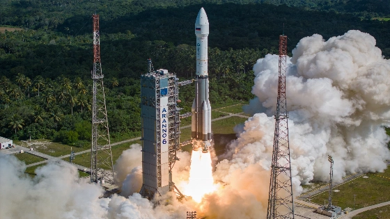
Europe's Ariane 6 rocket has launched the MTG-I2 satellite, completing the Meteosat Third Generation constellation for advanced weather monitoring from geostationary orbit
Europe's Ariane 6 launch vehicle has successfully delivered the MTG-I2 weather satellite to geostationary transfer orbit, marking a key milestone for European meteorological observation. The launch took place from Europe's Spaceport in Kourou, French Guiana, during a scheduled window on August 27, 2026. MTG-I2 is the final imaging satellite required to complete the Meteosat Third Generation (MTG) network, which is designed to enhance severe weather detection and climate monitoring across Europe and Africa.
MTG-I2 and the Meteosat Constellation
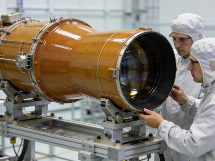
The MTG-I2 satellite, with a mass of approximately 3,800 kilograms, joins its predecessors MTG-I1 and MTS-S1 in geostationary orbit, 35,786 kilometers above Earth's equator. MTG-I1, launched in December 2022, provides high-resolution imaging, while MTS-S1, launched in July 2025, carries a sounder instrument for probing atmospheric layers in the infrared. Together, these satellites form a three-spacecraft system operated by the European Organisation for the Exploitation of Meteorological Satellites (EUMETSAT), supporting early detection of rapidly developing storms, improved weather forecasting, and long-term climate data collection.
Ariane 6 Performance and Launch Details
The Ariane 6 rocket, operated by Arianespace, is Europe's most capable launch vehicle, able to deliver up to 11.5 metric tons to geostationary transfer orbit in its heaviest configuration. The August 27 launch was the ninth for Ariane 6 since its debut in July 2024. The vehicle released MTG-I2 into its intended transfer orbit 36 minutes after liftoff, following a standard launch profile. For comparison, SpaceX's Falcon 9 can deliver up to 8.3 metric tons to the same orbit class. Ariane 6's reliability and payload capacity have made it a central component of Europe's space infrastructure, including recent missions such as the deployment of Amazon's broadband satellites to low Earth orbit in June 2026.
Scientific Capabilities and Applications
The MTG system is designed to provide continuous, high-resolution imagery and atmospheric sounding from geostationary orbit. Its instruments enable early identification of severe convective storms, more accurate weather forecasts, and improved monitoring of climate variables. The data are used for a range of applications, from aviation safety-helping aircraft avoid hazardous weather-to earlier flood alerts and more precise tracking of wildfires and fog. The MTG satellites represent a significant advance over previous generations, with enhanced spatial, temporal, and spectral resolution.
Context and Broader Impact
Geostationary weather satellites play a critical role in both meteorology and astronomy, providing real-time data that support not only weather prediction but also the planning of astronomical observations. For example, the importance of satellite weather data was highlighted during a Mediterranean eclipse cruise, where real-time satellite imagery enabled organizers to avoid cloud cover and secure clear views of the 2026 total solar eclipse, as described in this report on satellite-guided eclipse observation. The completion of the MTG constellation ensures that Europe will maintain independent, state-of-the-art capability for monitoring atmospheric phenomena from space.
Geostationary orbit is a unique region 35,786 kilometers above Earth's equator where satellites match the planet's rotation, appearing stationary over a fixed longitude. This allows continuous observation of the same region, making it ideal for weather monitoring. Satellites in this orbit can provide uninterrupted data streams, enabling rapid detection of developing storms and supporting both meteorological and scientific applications that require persistent coverage of specific areas.