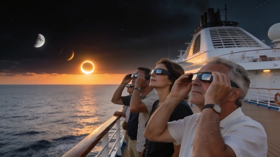
A Mediterranean eclipse cruise relied on real-time satellite weather data to avoid clouds and secure a clear view of the 2026 total solar eclipse, demonstrating the critical role of geostationary satellites in astronomical observation planning
On August 12, 2026, a cruise ship carrying eclipse enthusiasts navigated the Balearic Sea with a single goal: to witness totality as the Moon passed in front of the Sun. The success of this observation depended not only on careful planning but also on the ability to adapt to rapidly changing weather conditions, a challenge that has long shaped ground-based astronomy.
Satellite Monitoring and Course Correction
As the eclipse approached, the cruise ship Le Boréal, operated by Compagnie du Ponant, relied on real-time data from EUMETSAT, a geostationary weather satellite positioned 35,400 kilometers above Europe. Satellite imagery revealed the development of a large convective cloud mass over the Spanish coast near the Gulf of Valencia, threatening to obscure the Sun at the critical moment of totality. By analyzing these satellite images, the ship's meteorologist and captain adjusted course southwest, moving the vessel away from the projected cloud path and increasing the likelihood of unobstructed viewing.
This decision proved decisive. While other vessels in the region maintained their original routes, Le Boréal's maneuver placed it in a zone with only thin, high-altitude clouds, allowing for a largely uninterrupted view of the eclipse. The use of satellite data for tactical navigation highlights the growing integration of space-based Earth observation with astronomical event planning.
Observing Totality at Sea
At sunset, with the Sun just three degrees above the horizon, passengers gathered on the ship's upper decks equipped with eclipse glasses. The Moon's shadow swept across the sea, producing a rapid darkening and a brief but vivid diamond ring effect. The solar corona appeared tinged with yellow, likely due to atmospheric haze near the horizon, and a prominent red solar prominence was visible to the unaided eye. Totality lasted approximately 95 seconds, during which Venus was the only other celestial object clearly visible in the sky.
As the Sun reemerged, it took on the appearance of an orange-red crescent before setting below the horizon. The air temperature remained relatively stable, likely due to the thermal inertia of the surrounding water. No shadow bands were reported, and the overall light level never dropped to full night, consistent with the low solar altitude and brief duration of totality.
Weather, Mobility, and Astronomical Observation
The Mediterranean in August is typically dominated by high-pressure systems, producing warm and clear conditions. However, transient disturbances can introduce clouds and storms, as occurred two days before the eclipse when a weather system brought widespread cloud cover to the region. The ability to monitor atmospheric conditions in real time and reposition the ship was essential to the success of the observation. This approach contrasts with land-based eclipse expeditions, which are often limited by fixed locations and less flexible in responding to last-minute weather changes.
Recent astronomical events, such as the Perseids meteor shower observed earlier in August, have also demonstrated the importance of site selection and weather monitoring for successful viewing. For example, observers tracking the Perseids from dark-sky locations benefited from clear conditions, as described in coverage of the Perseids peak.
Limits and Implications for Future Events
While the use of satellite data and mobile platforms can greatly improve the odds of successful astronomical observation, these methods are not infallible. Rapidly evolving weather systems, instrument limitations, and the inherent unpredictability of atmospheric dynamics mean that even the best-prepared expeditions face uncertainty. The 2026 eclipse cruise demonstrates how integrating satellite meteorology with flexible logistics can mitigate some of these risks, but it also underscores the continued need for contingency planning in observational astronomy.
As more astronomical events draw international attention, the interplay between space-based Earth observation and ground-based or sea-based astronomy is likely to become increasingly important. The lessons from this eclipse cruise may inform future efforts to optimize viewing conditions for rare celestial phenomena.
Geostationary weather satellites such as EUMETSAT play a crucial role in modern observational astronomy by providing continuous, real-time monitoring of atmospheric conditions over large regions. These satellites detect infrared and visible light reflected or emitted by clouds, water vapor, and the Earth's surface, enabling meteorologists to track the development and movement of weather systems. For eclipse expeditions and other time-sensitive astronomical observations, this data allows for rapid decision-making and route adjustments, increasing the probability of clear-sky viewing. However, satellite imagery is limited by spatial and temporal resolution, and cannot always predict small-scale or rapidly forming clouds. Understanding these capabilities and constraints is essential for astronomers and expedition planners seeking to maximize observational success.