NASA scientists have measured how Earth's center of mass moves by millimeters each year as water, ice, and air shift across the globe, using satellite laser ranging and GPS data.
Earth's center of mass isn't fixed in place. Each year, as snow builds up in the north, rain fills the Amazon, and dense winter air settles over continents, the planet's mass shifts just enough to move its center by a few millimeters. NASA researchers have now measured these small changes more precisely than ever, showing that the annual movement is smaller than earlier estimates and closely linked to the seasonal movement of water, ice, and air.
Tracking Earth's subtle motion
Scientists have long tried to define and monitor the geocenter-the point where Earth's mass is balanced. If Earth were a rigid sphere, this point would stay put. But in reality, water flows, ice melts, and air pressure changes, all shifting the planet's mass and nudging the geocenter away from the geometric center by fractions of an inch. These small movements matter for satellite navigation, global mapping, and precise elevation measurements.
At NASA's Jet Propulsion Laboratory, geophysicist Donald Argus and his team developed a new method that combines satellite laser ranging (SLR), GPS tracking, and data from low Earth orbit satellites to refine estimates of the geocenter's seasonal motion. Their approach, published in Geophysical Journal International, also accounts for how the weight of water and ice deforms the crust, so ground stations aren't treated as fixed points. This method reduces the uncertainty in geocenter estimates, which previously could be as large as the motion itself-up to 7 millimeters, according to NASA Earthdata and recent news coverage.
Satellites and ground stations working together
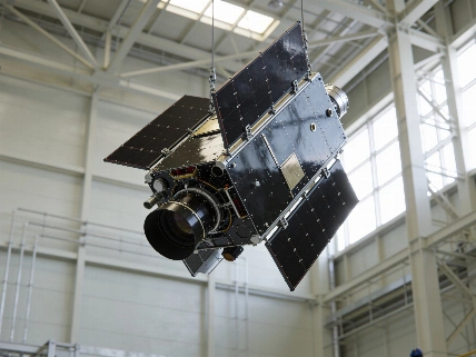
The Laser Geodynamics Satellites (LAGEOS 1 and 2), launched in 1976 and 1992, are central to these measurements. These heavy, reflective spheres-each about 408 kg-are tracked by a network of laser ranging stations in more than 20 countries. SLR is especially useful for monitoring changes in Earth's gravity field and the movement of the global station network relative to the geocenter, which is important for modeling long-term climate changes. But the uneven spread of ground stations has limited precision in the past. By adding GPS data and information from other satellites, the new method creates a more complete and reliable dataset.
The study found that the geocenter's annual movement is about half as large as previously thought. For example, snow in North America and Eurasia peaks in March, shifting the center of mass about 3 millimeters toward the North Pole. In April, heavy rainfall in the Amazon basin-up to 2,400 gigatons-moves the geocenter 2.2 millimeters toward South America. Monsoon rains in Southeast Asia and seasonal changes in the Pacific Ocean also play a role, with the Pacific's size making its effect especially noticeable.
Atmospheric and oceanic effects
Air mass also has an impact. Using models from the European Centre for Medium-Range Weather Forecasts, the researchers estimated that cold, dense air in winter tips the mass balance over regions like Arabia, Asia, and northern Africa in December, and over South America and South Africa in June. Between August and October, meltwater and rain cause the oceans to swell, shifting the geocenter toward the South Pacific. Even smaller seas, such as the Mediterranean and Barents, have minor but measurable effects.
These results match data from the Gravity Recovery and Climate Experiment Follow-On (GRACE-FO) mission, which has tracked monthly changes in Earth's gravity field since 2018. The GRACE-FO satellites, a joint project between NASA and the German Research Centre for Geosciences, detect mass movement by measuring tiny changes in the distance between two spacecraft as they pass over regions of different density. The next GRACE-Continuity mission is planned to continue this work after 2028, as reported in Nature.
Why it matters for navigation and science
Knowing the geocenter's position accurately is important for everything from global shipping to precision farming. Even millimeter-scale errors can affect satellite navigation, mapping, and climate monitoring. The improved method means that reference frames used by satellites and ground stations can be updated more confidently, reducing systematic errors in global positioning and elevation data.
The study shows that the mass of water and air moving between hemispheres each year is smaller than previously thought, sharpening our understanding of Earth's changing system. This work builds on decades of geodetic research and adds to earlier efforts to track planetary motion, such as those described in Science Report. The ability to track these small shifts highlights the progress in satellite geodesy and the value of combining different measurement techniques. The evidence shows that while Earth's center of mass is always moving, it can now be tracked in enough detail to support both science and practical navigation.
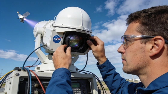
Satellite laser ranging is key to these measurements. The technique involves sending laser pulses from ground stations to satellites with retroreflectors, then timing the return signal to measure the satellite's distance with millimeter accuracy. By combining data from several satellites and accounting for crustal deformation, researchers can reconstruct the geocenter's position over time. Adding GPS and low Earth orbit satellite data improves coverage and reliability, making it possible to detect and interpret the small mass shifts that define our planet's true center.