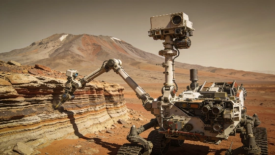
NASA's Curiosity rover has reached its 14th anniversary on Mars, continuing its ascent of Mount Sharp with detailed rock and environmental measurements using its suite of scientific instruments
NASA's Curiosity rover has completed 14 years since its landing on Mars, continuing to operate in the harsh Martian environment and returning new data on the planet's geology and atmosphere. The rover's latest activities have focused on the layered terrain of Mount Sharp, where it is investigating the relationships between different rock strata and the environmental processes that shaped them.
Anniversary Operations and Instrumentation
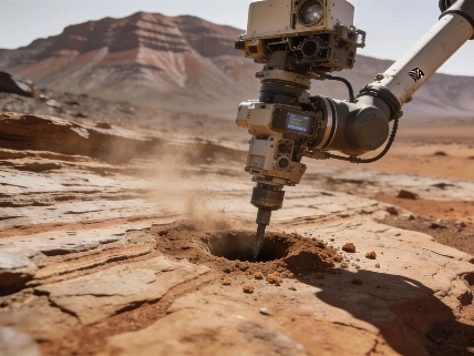
During the week marking its 14th landing anniversary, Curiosity's science and engineering teams coordinated a series of targeted measurements. On Sol 4976, the rover's arm was deployed to the target "Tunas Khasa" for an analysis using the Alpha Particle X-ray Spectrometer (APXS), a key instrument for determining elemental composition. The Mars Hand Lens Imager (MAHLI) captured close-up images of "Tunas Khasa" and "Villarrica," while the ChemCam instrument conducted laser-induced breakdown spectroscopy on "Lago Rupanco" and "Chulipa Punta." These observations are designed to characterize cross-bedding-intersecting rock layers that record ancient wind and water activity-and to clarify how different sedimentary units relate to one another.
Curiosity's Mastcam system was also active, acquiring five mosaics that document both nearby bedrock and more distant buttes. Notable targets included "La Linea," an eroded surface, and "Tiraque," which exposes bedrock layering. After a 14-meter drive, the rover positioned itself at a site where cross-bedded rocks are truncated by overlying layers, offering a rare opportunity to study the sequence of geological events in detail.
Geological Targets and Environmental Monitoring
At its new location, Curiosity planned additional APXS measurements on "Salar de Gorbea" and "Uriondo," with MAHLI imaging both targets and producing a large mosaic of "Tres Morros," a site exemplifying the contact between distinct rock layers. Mastcam continued to survey outcrops such as "Laguna Del Eulogio" and "Laguna de Pozuelo," which are relevant to understanding changes in stratigraphy and the formation of nearby buttes like Mishe Mokwa. ChemCam targeted "Rio Tranquilo," a nodular feature potentially linked to past water activity, and "Rio Juncalito," a cross-bedded outcrop. The instrument's Remote Micro Imager (RMI) was used to obtain high-resolution images of both the forward terrain and Mishe Mokwa.
Environmental monitoring remained a priority, with Curiosity conducting dust devil surveys, measuring atmospheric opacity, and tracking wind conditions. The Radiation Assessment Detector (RAD) continued its long-term monitoring of the Martian radiation environment, a critical factor for future human exploration. These environmental datasets complement the geological investigations by providing context for surface processes and habitability.
Mission Status and Technical Challenges
Curiosity's ascent of Mount Sharp involves navigating steep and uneven terrain, with the rover experiencing tilts up to 24 degrees. The engineering team carefully plans each drive to ensure the rover's safety and stability. Routine maintenance activities, such as cleaning the Sample Analysis at Mars (SAM) instrument columns and imaging the REM UV sensor, are included in the operational schedule to maintain instrument performance. The rover's ability to continue science operations after more than a decade on Mars highlights the robustness of its design and the adaptability of mission planning.
Curiosity's ongoing work builds on a legacy of Mars exploration that includes both remote sensing and in situ analysis. The mission's focus on sedimentary structures and environmental monitoring provides a detailed record of Martian surface evolution. For comparison, recent advances in planetary imaging-such as the vivid capture of comet 220P/McNaught during a bright outburst-demonstrate the value of combining ground-based and robotic observations to understand dynamic processes across the solar system. Readers interested in such observational achievements can find more in this report on comet imaging during a rare outburst event.
Scientific Implications and Remaining Questions
The stratigraphic relationships Curiosity is documenting at Mount Sharp are central to reconstructing the planet's environmental history. Cross-bedding and truncation features suggest episodes of wind-driven deposition, erosion, and possible water activity billions of years ago. However, the precise timing, duration, and environmental conditions associated with these processes remain uncertain. The rover's chemical and imaging data help constrain models of sediment transport and diagenesis, but many questions about the persistence of water and the potential for habitable conditions in Gale Crater are unresolved.
As Curiosity enters its 15th year of operations, the mission continues to refine our understanding of Martian surface processes. The integration of chemical, textural, and environmental data is essential for interpreting the complex history recorded in Mount Sharp's rocks. Ongoing analysis and future observations will be needed to resolve outstanding uncertainties about Mars' past climate and habitability.
To interpret Curiosity's findings, it is important to understand how its instruments work together. The APXS determines elemental composition by measuring X-rays emitted from a target after exposure to alpha particles, while ChemCam uses a laser to vaporize rock and analyze the resulting plasma. MAHLI provides high-resolution images of textures and structures, and Mastcam creates color mosaics for geological context. Environmental sensors track dust, wind, and radiation. By integrating these diverse datasets, scientists can reconstruct the sequence of geological events and assess the potential for past habitable environments on Mars.