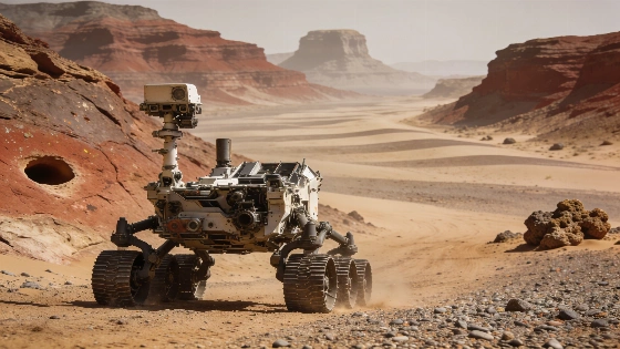
NASA's Curiosity rover is examining subtly banded terrain in Valle Grande, where new contact science, panoramic imaging, and centimeter-scale rock features are helping map the geological transition across Gale Crater's sulfate-rich slopes.
Curiosity has reached a stretch of Mars where the most important clues are not dramatic cliffs or bright minerals but faint changes in tone and texture. During Sols 5010-5015 of the Mars Science Laboratory mission, the rover moved through a subtly banded area in the valley informally called Valle Grande while testing rough bedrock and documenting the surrounding buttes.
A landscape of bands
The bands span roughly 25 to 200 meters in diameter. Some contain more sand and fewer exposed rocks, making them appear darker from a distance, while others show more continuous outcrop that allows the team to trace approximate contacts between neighboring units. Those visual differences are observations of surface form and tone; they do not by themselves establish how the rocks formed.
Valle Grande lies inside Gale Crater on the slopes of Mount Sharp, the central mountain that Curiosity has been climbing and studying for years. Independent reports place the rover in this same valley during a period when unusual centimeter-scale holes or depressions were documented in nearby rock. The features are reported to be about 1 centimeter, or 0.39 inches, across; a related image composite was created on Aug. 19, 2026, at 07:59:21 UTC. Their origin remains unresolved, and the observations should be treated as a geological description rather than evidence of a specific process.
The setting follows Curiosity's climb across what the team interprets as an erosional supersurface - a boundary marking a gap in the usual rock record. The rover is now traversing terrain with sparse nodular outcrops surrounded by sand and coarse pebbly material. That combination makes the choice of targets consequential: accessible rock is limited, but each reachable block can provide a more direct test of the terrain than a distant image.
Reports also associate Valle Grande with a layer rich in sulfates, making the valley useful for comparing rock units formed or altered under different chemical conditions. NASA's long-duration traverse is therefore examining not only exposed bedrock but also the transitions between resistant layers, loose sediment, and sand-covered surfaces.
Curiosity's progress places this local campaign within the wider sample-return plans shaping Mars exploration. Unlike returned material, these measurements are being made directly at the surface and interpreted through the rover's instruments in their immediate geological setting. The approach is consistent with the broader planetary-science strategy described by ESA's Mars exploration program, in which orbital context and surface measurements complement one another.
Contact science targets
On Tuesday, the rover used APXS and MAHLI to examine brushed nodular bedrock at Cerro Armazones and Monte Melimoyu. ChemCam conducted LIBS measurements on a cluster of dark-toned nodules at Tuta Huallpas and on the dark-toned float rock Acllahuasi. These targets were selected from the limited exposed rock available around the rover rather than from a continuous cliff face.
APXS provides information about elemental composition, MAHLI records close-up texture and grain relationships, and ChemCam's laser-induced breakdown spectroscopy examines the chemistry of small areas without requiring the rover to approach with a drill. Used together, the instruments can distinguish visual impressions from measurable differences in composition and texture.
After a drive of about 60 meters on Friday, Curiosity arrived beside mostly sandy ground. Only one small rough-textured outcrop was close enough for contact science and LIBS, but its structure made it a valuable target. The block contains abundant small flakes and chips as well as laminated areas that are somewhat smoother. The rough surfaces will be examined with MAHLI at Yungay and Chiu Chiu, with APXS at Chiu Chiu, and with ChemCam LIBS at Puya Raimondii. ChemCam will also investigate the smoother area at Liolaemus Tacnae.
The plan illustrates the practical limits of rover geology. Curiosity cannot choose any rock visible on the horizon; it must work with the outcrops that are physically reachable after a drive. Here, a single block offers several textures for comparison, allowing the team to test whether its rough and laminated portions represent meaningful material differences within the same exposure.
Independent accounts of the Valle Grande observations further report that ChemCam, MAHLI, and APXS examined gray, rough, resistant layers that differ from the surrounding rock. Such contrasts may indicate a different chemical history, but the available observations do not yet identify a unique origin. As in other NASA planetary investigations, interpretation depends on combining morphology, chemistry, stratigraphic position, and repeated measurements rather than relying on one unusual image.
Views beyond the rover
Long-distance imaging is expanding the investigation beyond the immediate contact targets. Mastcam and ChemCam acquired larger mosaics of the buttes on either side of the rover, Mishe Mokwa and Cordillera, along with a view back toward the smaller butte La Linea. Mastcam also revisited the Chocolatal scuff analyzed during the previous week and recorded a broader mosaic of the Sullivan Field sand field where it lies.
A related panorama of Valle Grande was assembled from 323 individual Mast Camera images taken on Aug. 1-2, 2026. The composite provides visual context for the rover's route through the valley and helps place small contact targets within a larger pattern of buttes, slopes, sand, and exposed rock. Panoramas of this kind are especially useful when isolated close-up images could otherwise make a local feature appear more representative than it is.
Sullivan Field contains sand ripples, mega ripples, and transverse aeolian ridges. The field was named in honor of Robert Sullivan, described in the mission update as a world expert on Martian sands and a member of the Curiosity science team. These landforms give the rover a separate record of surface movement alongside its work on bedrock and contacts.
Routine work after milestones
The six-sol period followed several recent milestones for the mission. Curiosity marked its 14th Landiversary on Aug. 6, passed the 1-kilometer elevation mark, and reached its 5,000th sol in early September. Its next major date is Nov. 26, the 15th anniversary of launch, while the current operations have returned to a more routine schedule.
After 14 years on the surface, NASA's rover continues to encounter terrain that complicates simple explanations. Valle Grande remains an active geological-analysis zone because it brings together resistant rock bands, loose material, sulfate-associated layers, and small features whose relationships can be tested only through measurements made at the surface.
Environmental monitoring continued in parallel with the geology. Navcam and Mastcam observed the route ahead, while the environmental team planned dust-devil movies, suprahorizon movies aimed at the crater rim, and tau images used to monitor dust in the atmosphere. The route image acquired with Curiosity's Right Navigation Camera on Sept. 14, 2026, at 02:05:20 UTC corresponds to Sol 5014 and shows the subtle bands mainly through tonal differences.
Those bands are therefore a mapping problem before they are a geological explanation. The rover team can compare their morphology, sand cover, outcrop continuity, and rock textures as Curiosity approaches them, but the current view cannot determine whether every tonal boundary represents a distinct material or merely a change in surface cover. The strength of this campaign lies in combining regional mosaics with measurements from reachable rocks rather than treating a distant pattern as a finished interpretation.
For readers, the essential distinction is between a rover image and an instrument-based geological inference. The camera records differences in brightness and texture across the scene, while APXS, MAHLI, and ChemCam contribute separate observations from selected targets. Together they can constrain how neighboring surfaces differ, but the evidence remains local and comparative. Curiosity's latest traverse is valuable precisely because it turns a subtle visual pattern - and the newly reported centimeter-scale depressions - into a sequence of testable measurements instead of claiming that the bands or holes already have a settled origin.